Rover Location Database
Washington Rover Locations
- WA Map
- WA List
- WA from CN87
- Rare WA Grids
- WA Counties
- CN76 Long Beach
- CN77 Forks
- CN78 Sekiu
- CN85 Portland
- CN86 Centralia
- CN87 Seattle
- CN88 Belling'm
- CN95 The Dalles
- CN96 Yakima
- CN97 Mt Rainier
- CN98 Mt Baker
- DN05 Pendleton
- DN06 Tri-Cities
- DN07 Moses Lk
- DN08 Okanogan
- DN16 Pullman
- DN17 Spokane
- DN18 Colville
- Add a Place
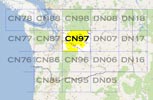
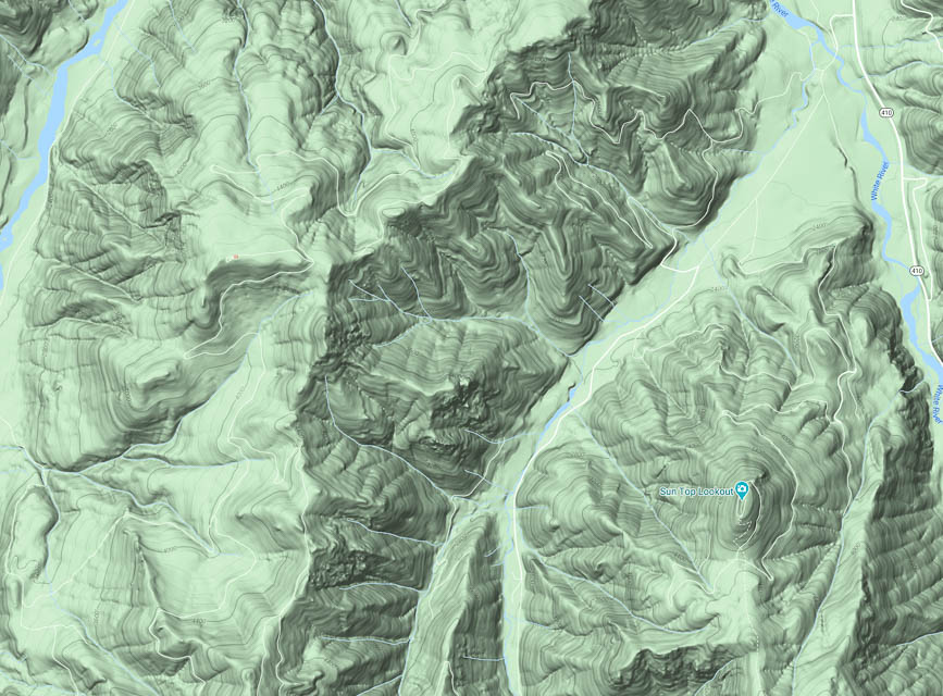
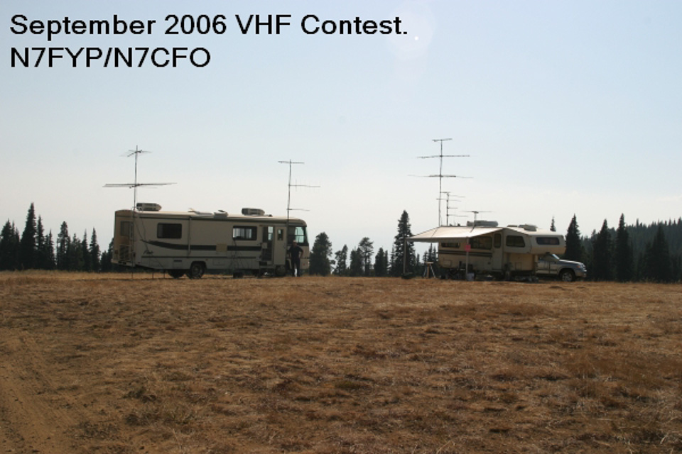
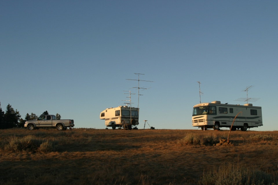
Grid Square CN97
26 locations - Badger Mtn - Raven Roost - Monroe Fairgrounds - Jr Point Campground - Haller Pass - Huckleberry Ridge - Sun Top Lookout - Red Top Mtn - Keechelus Ridge - Amabilis Mtn - Wild Horse Wind Farm - Kings Lake Road - Ridge Near S. Prairie Creek - Chelan Butte - Snoqualmie Ridge - High Rock Road - I-90 Indian John - Tronson Ridge - Quartz Mtn - Cle Elum Ridge - CN86-87-96-97 - Badger Mt - Lion Rock/Table Mtn - Mirrormont - Highland Drive - Mission Peak
Potential VHF rover sites in Washington grid CN97.
CN97 dimensions are 93.4 by 69.2 miles.
Explore this grid in Google Earth or equivalent:
Badger Mtn, CN97vn89
| Latitude, Longitude |
|---|
| 47.583283, -120.180352 |
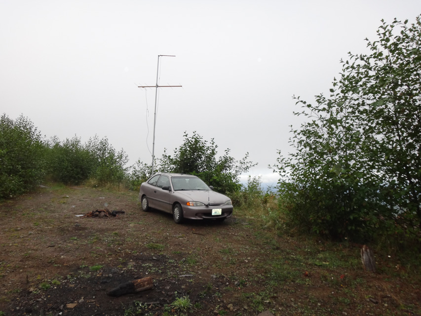
Raven Roost, CN97ha96
| Latitude, Longitude |
|---|
| 47.027022, -121.336761 |

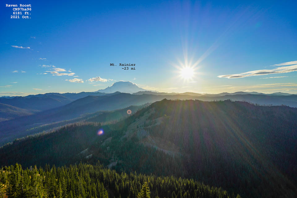
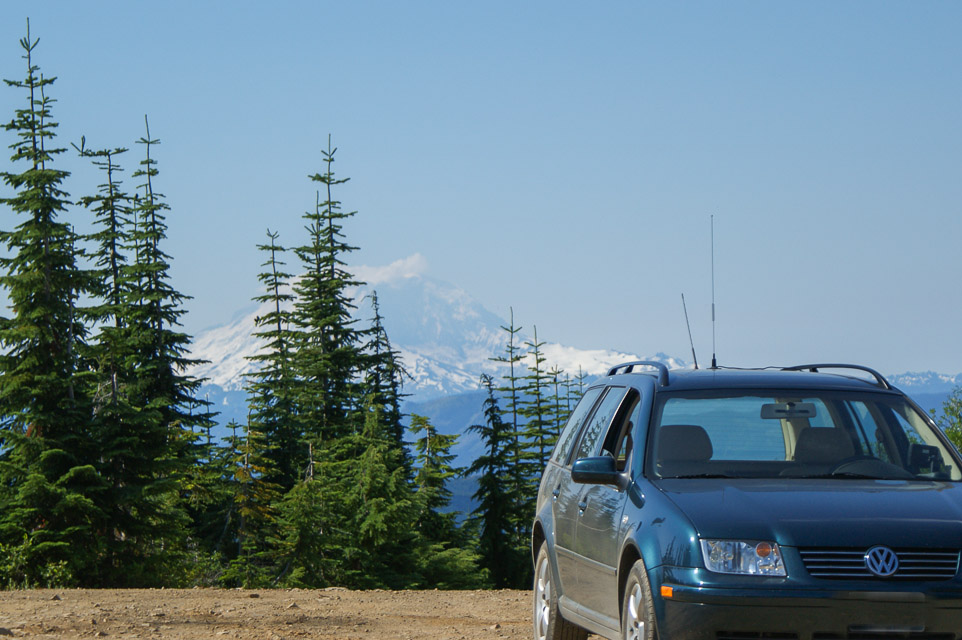
SOTA Summit W7W / MC-038
Easy drive up with any car in 2021. There is an old ATT Long Lines microwave site with some horns still up, but not operational. Someone told me a rumour on SSB that a HAM actually the owner of the site now. Should build a contest station there!
The car park is open to public. It has open microwave path into Yakima and Seattle, and it is right in between. There are two concrete buildings on top with a good size parking area. I used 144 MHz sideband from here with no RF noise.
- Peter AF7GL
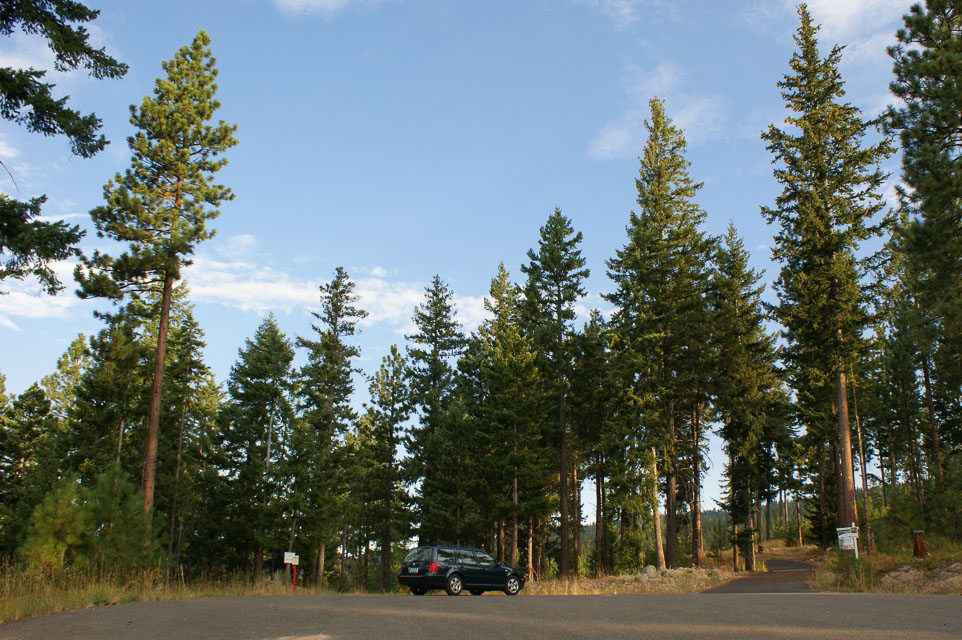
Monroe Fairgrounds, CN97au08
| Latitude, Longitude |
|---|
| 47.868620, -121.994810 |
The Evergreen State Fairgrounds in Monroe is on the valley floor with hills within a mile or two in all directions. It's not all that good, but if you want a quick stop in CN97 it's just inside the grid line and easy access.
There is a campground on the south side, but "RV2" is seasonal and closed winters.
Restrictions: Be aware of the special event schedule that will completely fill parking lots. This is a busy place; there are small events every weekend.
Jr Point Campground, CN97tx18
| Latitude, Longitude |
|---|
| 47.994271, -120.400694 |

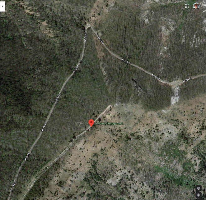
Jr Point Campground is on a treed ledge looking out over Lake Chelan with a great view up and down the lake. It has a concrete foundation for a former fire lookout tower. There is another small primitive campground at 4K feet heading up to Junior Pt.
Driving directions: On the road from 25mile State Park to Shady Pass. The top is often very muddy in June-July but the road up starting from the Lake side is usually good.
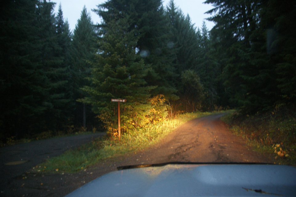
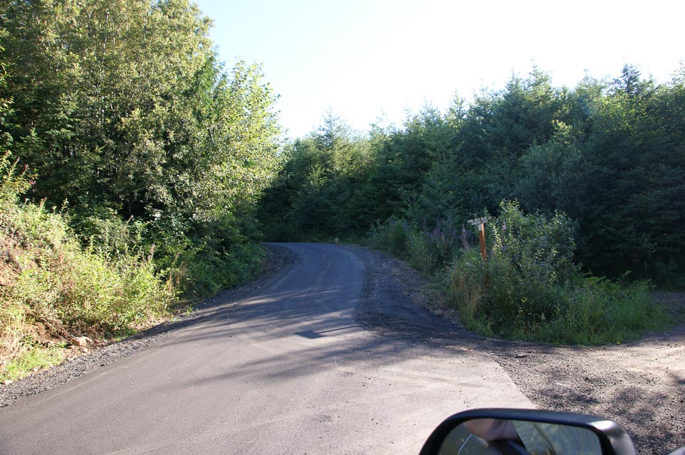
Haller Pass, CN97eb24
| Latitude, Longitude |
|---|
| 47.061400, -121.649689 |
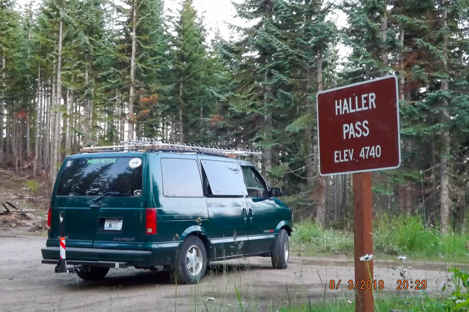
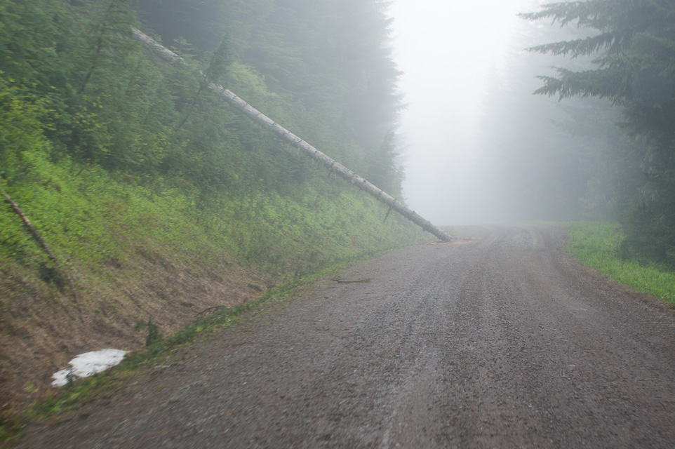
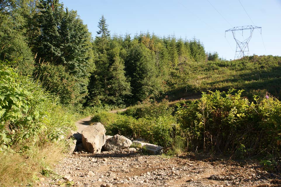
Haller Pass is a pull-off on the main (unpaved) road, about 8 miles in along the way to Strawberry Ridge (another 3 miles further south). This is the next ridge line to the west of Sun Top Lookout.
It is at a high point with an intersection of three smaller and short dead-end roads. We believe that one road, NF-310, gets you to a SOTA activation zone.
See the Topozone Map.
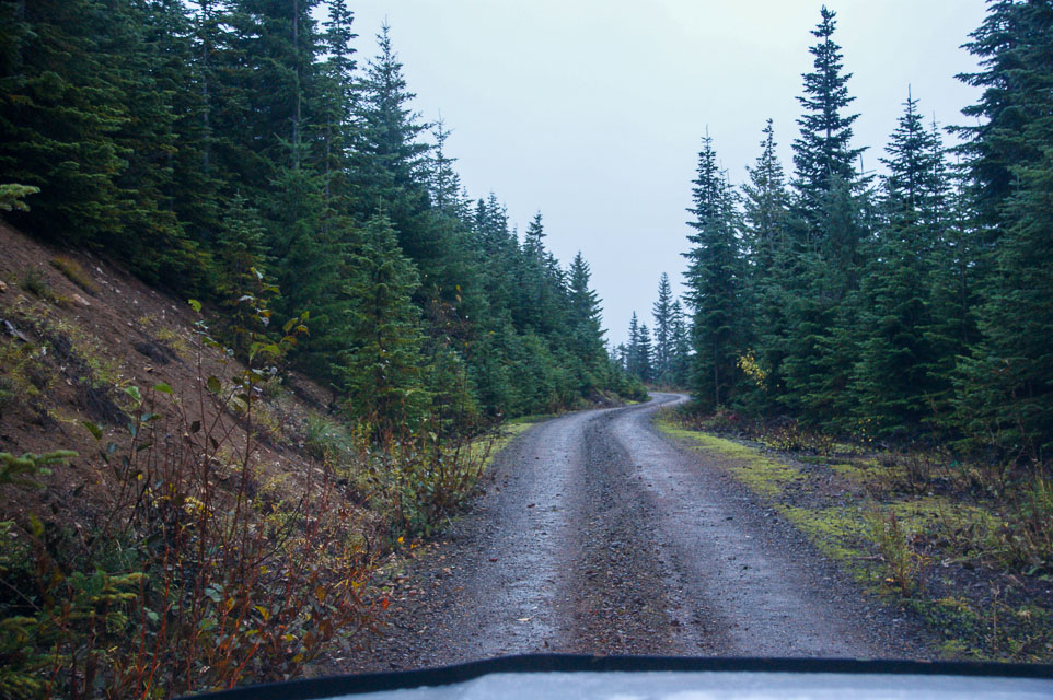
Huckleberry Ridge, CN97eb10
| Latitude, Longitude |
|---|
| 47.045730, -121.651414 |


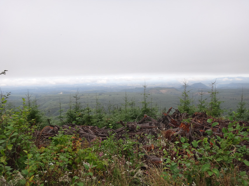
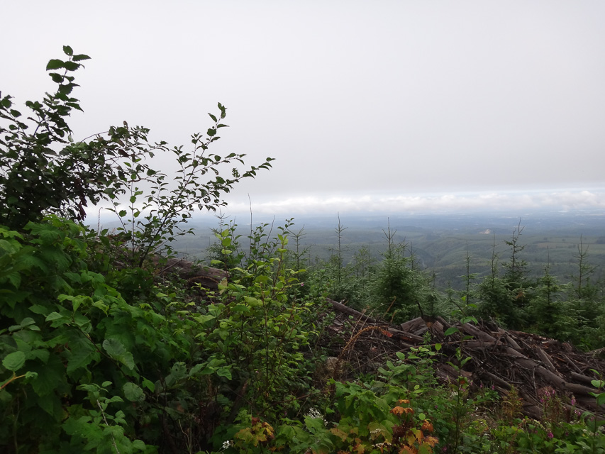
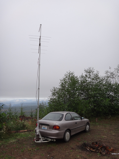
Three miles west of Sun Top Lookout, near Haller Pass, is this wide-open football-field sized area that accomodates several vehicles at generous social-distancing range. It's a very good camping spot and has been used for Field Day several times. The unpaved forest roads were in very good condition in 2020. Any sedan or trailer-towing would have no problem.
It has a good view east and west, and low rises to north and south. To the SSW is Mt Rainer which can be used as a good microwave reflector for the Puget Sound area.
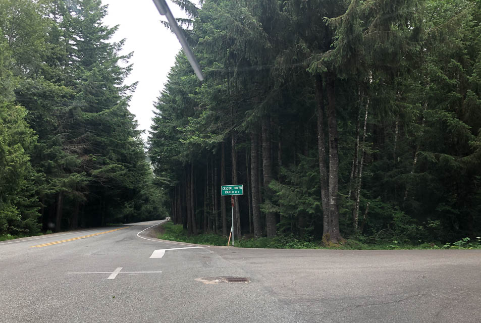
Driving directions: From Enumclaw head east on Hwy 410, the Chinook Pass road.
From the city of Greenwater (47.15599, -121.6548) continue east about three miles.
Right on FR 74 (Crystal River Ranch Rd)
Left at the fork in the road (toward FR 75),
Then take the second right (NF 75001) up the hill on the gravel road
Zero your odometer at this point and follow the most traveled road
At 3.3, 3.7, and 4.5 miles, ignore the roads to the left and up hill
At 8 miles, you will come to Haller Pass
At Haller Pass, scout the road to the left if interested in seeing the eastern horizon (150 yards or so).
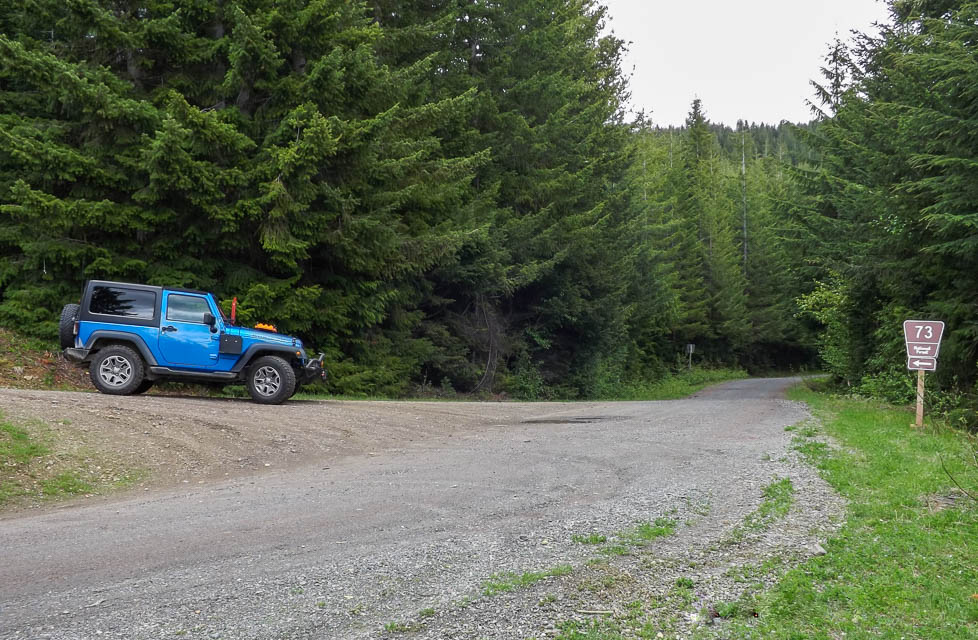
At 10.7 miles you will see the "FR 73" sign, at a sharp left uphill road... turn left!
There's a picture of Mihai's Jeep at the turn-off to FR 73
The next time you see any kind of a clearing, you have arrived at Huckleberry Ridge
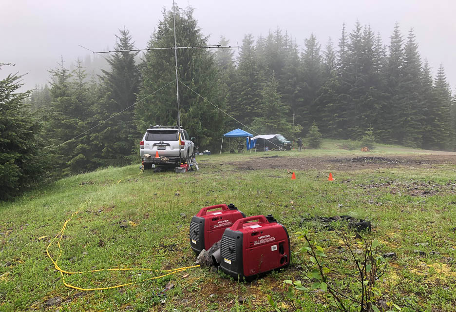
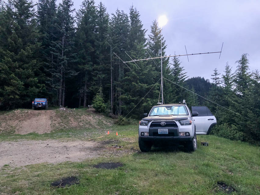
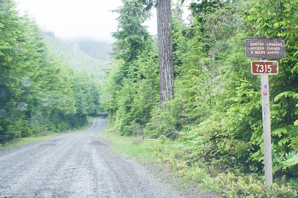
Sun Top Lookout, CN97ea89
| Latitude, Longitude |
|---|
| 47.041153, -121.596077 |
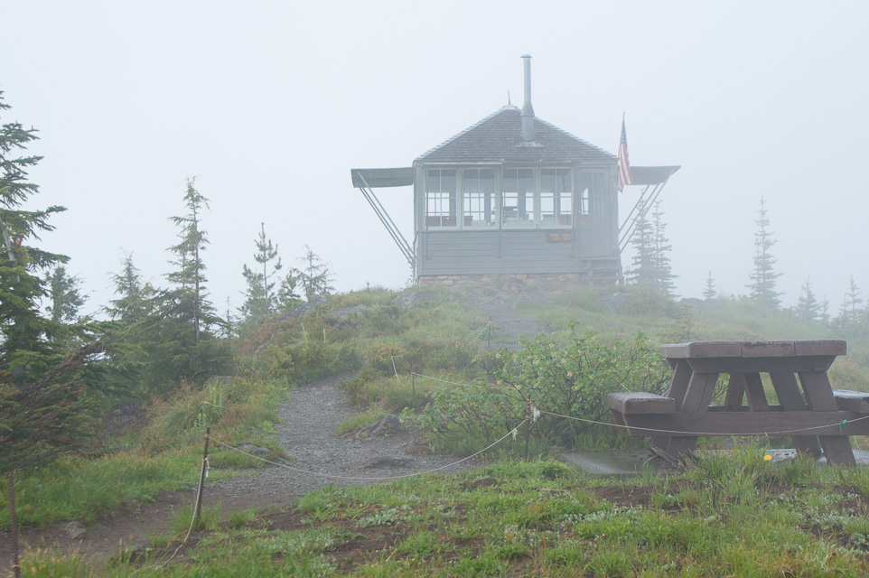

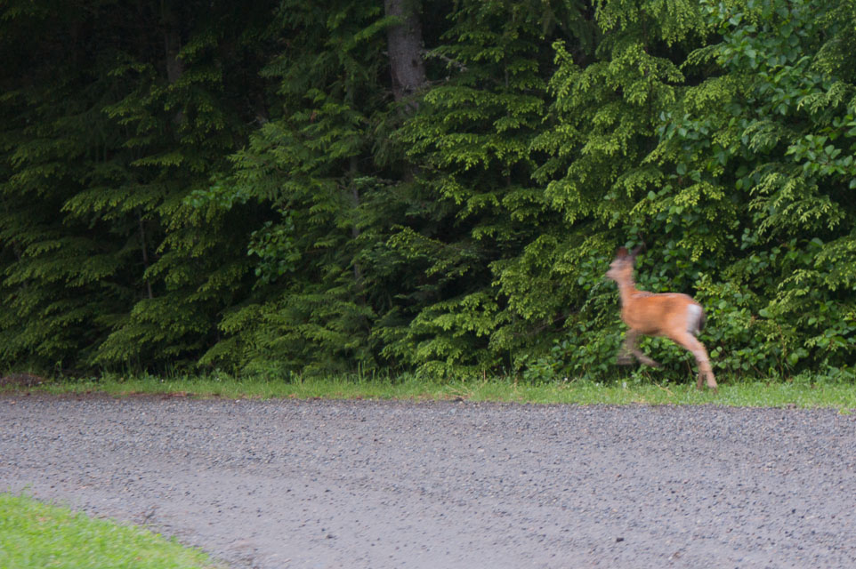
In the Mt Rainier National Park is a lofty lookout long used for forest fire spotting. It is now manned by volunteers and you can drive almost to the top at the 5,000' level. Visitors are welcomed at the lookout. This is a great spot to operate a portable radio or have a picnic.
Camping is not allowed, but could be done with a permit. Stopping or parking at Sun Top requires a Discover Pass; buy it in advance from a sporting goods store or other outlet.
There is an outhouse and picnic tables near the watch tower. Be careful of wildlife, as bears and deer are common.
Driving directions: Go east from Enumclaw on Highway 410
- Go south on Forest Road 73 about 1.4 miles
- Turn left onto Forest Service Road 7315 about five miles up a fairly steep dirt road
- Watch for road hazards; snow and fallen trees can happen year-round
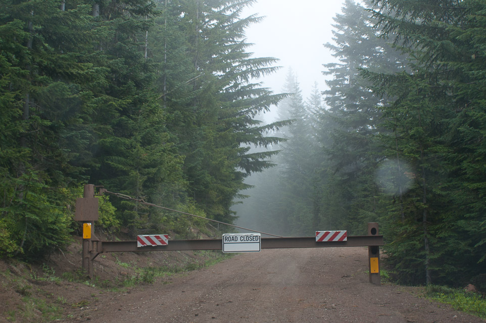
- The road is closed one-half mile from the top, so be ready for a steep
climb. Unfortunately the parking area by that gate does not have good radio propagation.
Red Top Mtn, CN97oh82
| Latitude, Longitude |
|---|
| 47.301583, -120.760611 |
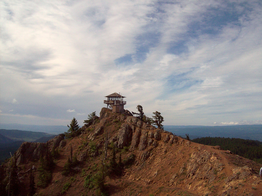
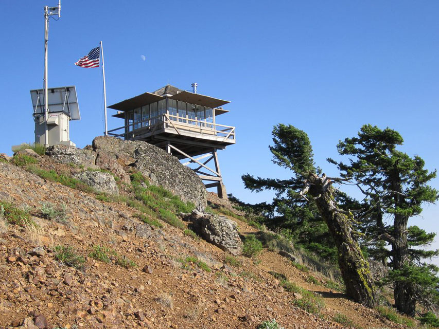
Red Top Mountain is near Teanaway Ridge, off Highway 97 north of Cle Elum. The lookout is staffed in summer.
Read more about Red Top at Summit Post and Peak Bagger and SOTA Red Top W7W/CW-061.
Restrictions: It doesn't look like vehicles can reach the lookout.
Keechelus Ridge, CN97ii33
| Latitude, Longitude |
|---|
| 47.347500, -121.307670 |
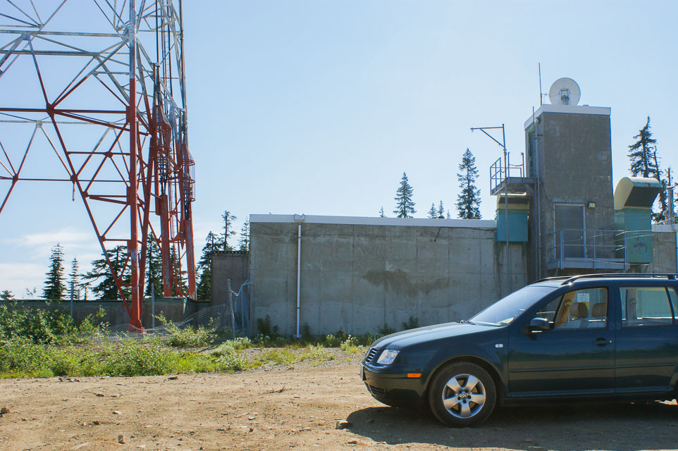
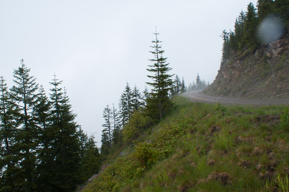
This is an excellent location with views in all directions. A large microwave tower occupies the central area and a rough but drivable road rings the installation.
Recommend to use a vehicle with good ground clearance as the dirt road is very rocky in places. The track from bottom top is 5.3 miles, 20 minutes and gains 3,260' of altitude.
Driving directions:
- I-90 exit 62 - "Stampede Pass, Kachess Lake"
- Turn north, follow paved road 1.7 miles
- Turn left on Forest Road 4934 opposite sign "Lodge Creek Estates"
- Go 4.4 miles to four-way intersection with FR 126 (unmarked)
- Turn right onto FR 126
- Go 0.3 miles, keep left at Y intersection with FR 122
- Follow roads that go up (not down) about 1 mile
Restrictions: A Discover Pass is required to use this spot. No services - bring your own water and supplies.
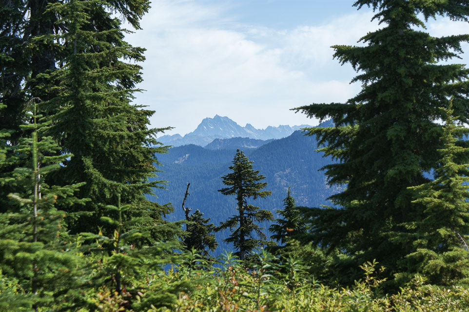
Amabilis Mtn, CN97ig89
| Latitude, Longitude |
|---|
| 47.290688, -121.261538 |
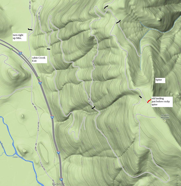
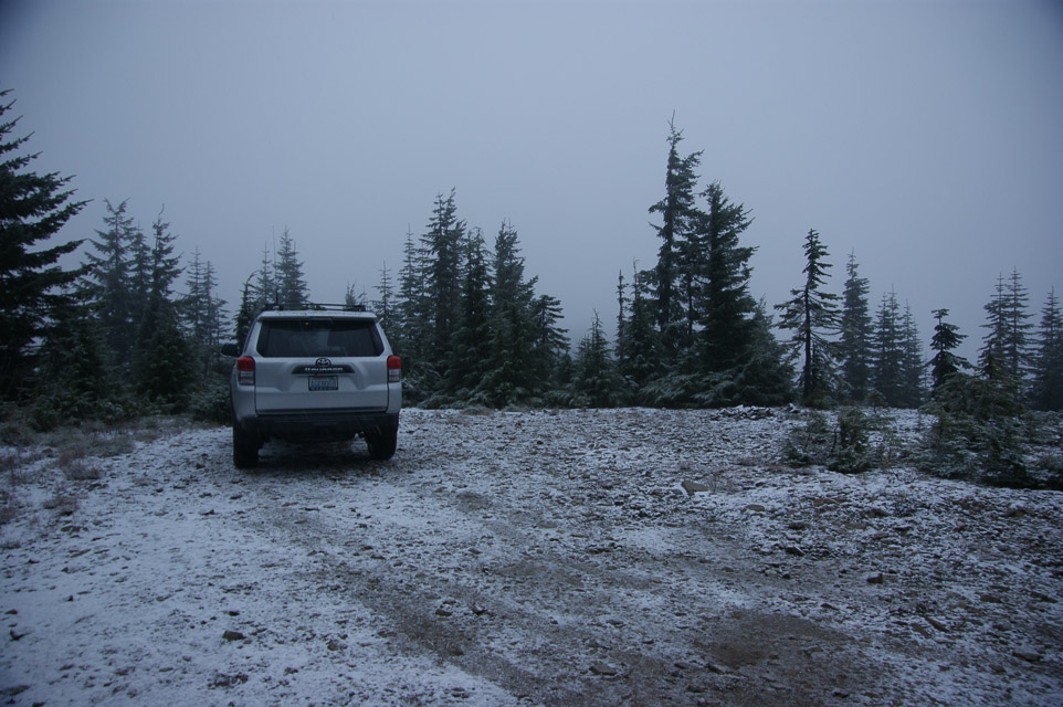
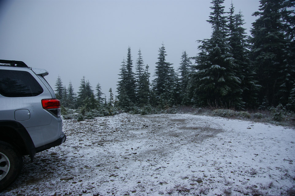
Amabillis is located off I-90 Exit 63 (Cabin Creek Road) on Snoqualmie Pass. See map with the proper forest roads to use to get there. This spot is suitable for car camping or with a little preparation you can set up a tent.
The operating site is old log landing just below the rocky spine of the mountain. The rocky spine is also a SOTA peak.
There are several similar landings on top of the ridge. It's worthwhile to explore. For example, there is a slightly better landing nearby at 47.28904/121.26044 at 4,354'. There is a better access road, bigger parking area, a tank trap, and better propagation to SE. It is an easy walk south about 100 yards from the landing shown here. But the travel choice depends on taking a right fork much further down the mountain, about 2 miles away.
Driving directions: Basically you take the first right up the hill signposted "Amabilis Mt". Take all the left forks and you should eventually find the landing on top. Allow at least 20 minutes to reach the top.
Easily passable by ordinary cars using reasonable care for rocks, potholes, fallen branches, blind corners, one-lane road, switchbacks and some big rain run-off trenches near the top. You know, the usual.
Restrictions: The site is subject is around 5K feet high and subject to bad weather and being "in the clouds".
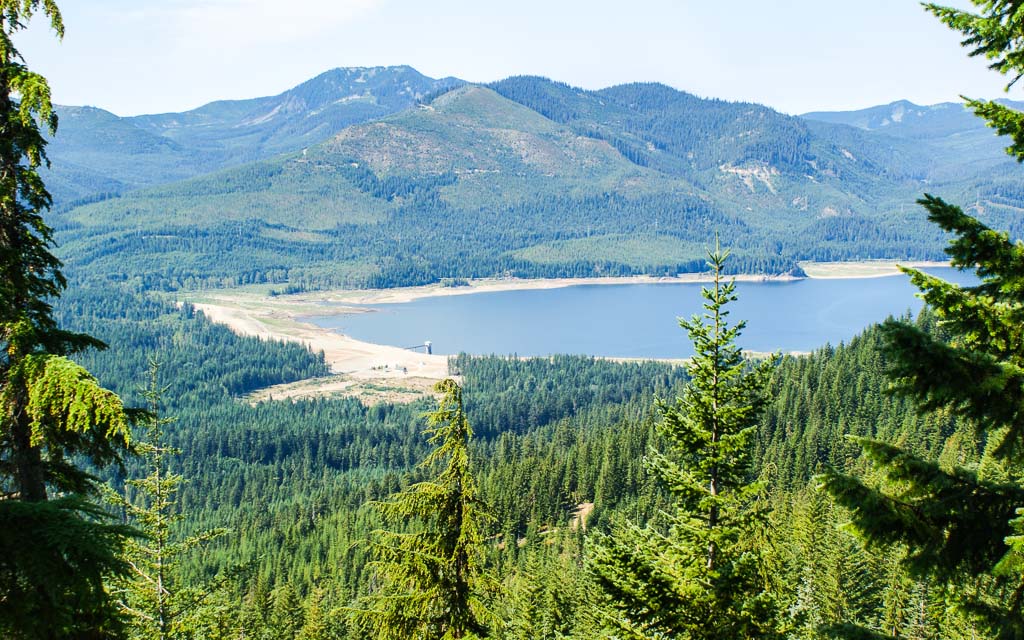
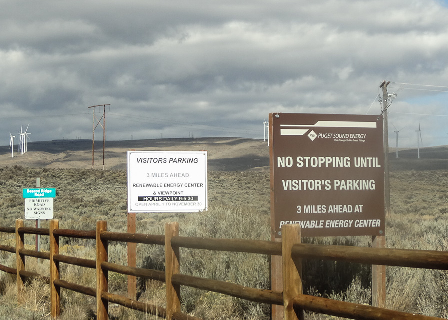
Wild Horse Wind Farm, CN97va52
| Latitude, Longitude |
|---|
| 47.011864, -120.200075 |
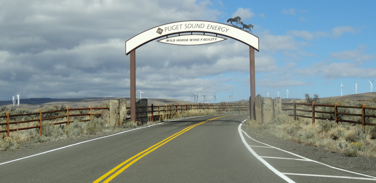

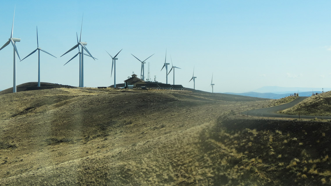

The Wild Horse Visitor's Center has excellent exposure east and west, with a good gravel parking lot.
Puget Sound Energy is friendly toward using the land for all sorts of recreation. Read more about the visitor center from Puget Sound Energy here.
The CN97-CN96 grid line is between the visitor's center and the front gate.
Driving directions: Excellent pavement all the way to the big gravel parking lot by the Visitors Center. This is probably the best operating spot, but gravel roads continue on for dozens of miles to the north. To reach any of the hills in this area you must exit I-90 in Ellensburg or Vantage.
Restrictions: Open from April 1 - November 30.
Visitor's Center building is open from 9 am to 5:30 pm daily, weather permitting.
Gates to road access are open from two hours before sunrise to two hours after sunset.
To get permission to walk the grounds,
complete the online application form.
Kings Lake Road, CN97at92
| Latitude, Longitude |
|---|
| 47.802288, -121.922900 |
This is a reasonably high CN97 spot near the NW margin of the grid, only 8 miles (20 minutes) from Duvall. It's 19 miles (40 minutes) from I-405 and 522.
The dirt road is a branch off of Kings Lake road. The Garmin GPS might mis-place Kings Lake road; continue on 0.2 miles to the proper signpost.
Someone sure made a mess of their campsite under the power line towers: trash, beer cans, shotgun shells, old rusted pickup truck, etc. No wonder so many of these places are gated or closed.
Driving directions: From the Monroe-Duvall road:
- Head East on Cherry Valley road.
- It becomes Lake Frontal Road.
- Just after Kayak Lake Road (on the right) turn left onto Kings Lake Road.
- After 0.2 miles, take the paved left fork in the road (signposted Camp Hamilton).
- Go about 0.4 miles to an area where you can pull over next to a private road.
Restrictions: There are high tension power lines within a half mile.
Ridge Near S. Prairie Creek, CN97ab65
| Latitude, Longitude |
|---|
| 47.064714, -121.948200 |

Spectacular and fairly accessible spot that overlooks much of the Puget Sound region.
Darryl WW7D: This is a great spot to hit after working out of CN86, CN96, and CN87 on Mowich Lake Road. The road is a little rough in spots, but is doable by a small passenger car.
Matt KC7OOY: In summer of 2021 we went up into this area for the June VHF contest, and found that NF-77102 was gated at 47.080444, -121.958167. Not sure if it is a seasonal closure, so just be aware of the possibility.
Driving directions: From Wilkeson, turn East on Railroad Ave.
- From this point, you are 9 miles from your destination and it will take about 30 minutes to get there.
- Turn right onto Snell Lake road.
- At the end of the road, turn right onto S Prarie Creek road.
- This becomes NF-7710.
- After 3 miles, the road forks into NF-7720 (left) and NF-7710-2 (right).
- Take the right fork and follow it another 4.4 miles.
- You will be a bit over 3,000' high with a peak to your right.
- Look for a small road on the right (NF-410) that heads uphill.
- Take that road to a small flat clearing with a fire pit in the middle.
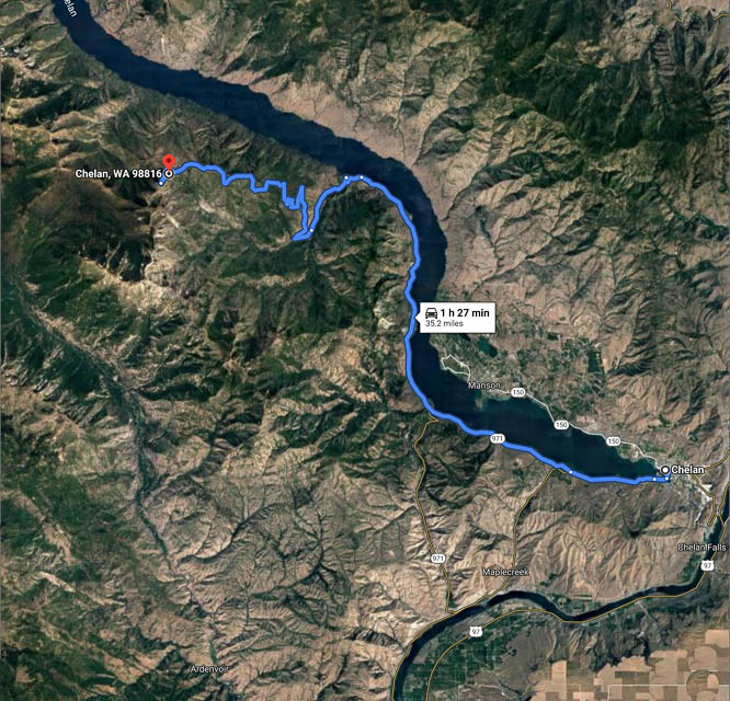
Chelan Butte, CN97xt53
| Latitude, Longitude |
|---|
| 47.807217, -120.034611 |

In CN97 on Chelan Butte to start the contest. Great views of eastern Washington shared with the local hang gliders that fly into the Columbia River Basin below. View is south towards I-90 mountain pass corridor with Seattle over the mountains to the right more. Microwave towers are located on another rise not far off but far enough away to cause no problems.
Snoqualmie Ridge, CN97bm48
| Latitude, Longitude |
|---|
| 47.534317, -121.879333 |
Subdivision under construction. North of I-90 and Highway 18 intersection.
This site is about five minutes from the I-90/Highway 18 intersection. It has good VHF exposure to the north, south, and east, but is marginal above 432. It is a good idea to take compass headings from this location because I-90 runs NW/SW and is a poor reference point.
Driving directions: From I-90 take Snoqualmie Ridge exit
- Go north approximately two miles
- From Highway 18, cross I-90 and go north approximately two miles
- This area is under constant construction
- You may have to wander around a bit to find a good operating site
- One of the better sites is an open lot under the power lines near the
central part of the business area
High Rock Road, CN97at62
| Latitude, Longitude |
|---|
| 47.800000, -121.950000 |
This is a logging landing on Highway 203 between Preston and Monroe.
The entrance is gated, but someone lives further down the road, so it will likely be open. There are high tension lines about 150 yards south, but they did not give Lynn any trouble during the June 2001 contest. This site had an excellent path to the west and north.
There are two roadside locations just before you get to this site, so if the gate is closed, try one.
Driving directions: From Highway 203 south of Monroe go up Cherry Valley Road approximately 1 mile.
- Start looking for pull-offs just past the intersection with High Rock Road.
I-90 Indian John, CN97nd88
| Latitude, Longitude |
|---|
| 47.161280, -120.848660 |
Indian John Rest Area. I-90 eastbound and westbound, mile 89. Good exposure east west and north. Ridge approx 1 mile south blocking UHF.
Tronson Ridge, CN97rj04
| Latitude, Longitude |
|---|
| 47.393500, -120.577500 |
This is a mountain top ridge near Blewett Pass. There is a great shot both east and west. The north view is a little blocked by dirt, but south is pretty clear.
Driving directions: I-90 East, exit 85 near Cle Elum
- Follow US 97 over Blewett Pass
- Five miles from the summit take Forest Service road FS 7224. (marked as "5 Mill Road")
- Follow the road about 3.2 miles, avoid all side roads and you pop out at the top of the ridge
Restrictions: Requires 4x4.
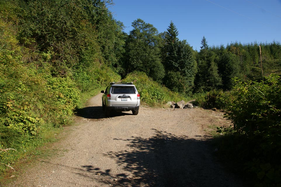
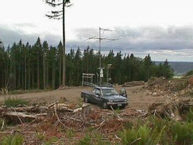
Quartz Mtn, CN97lb07
| Latitude, Longitude |
|---|
| 47.073892, -121.080029 |

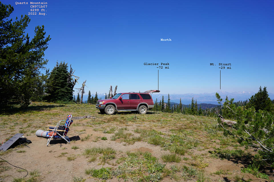
Quartz Mountain is a a 6,000' peak about 10 miles south of Cle Elum. It is reached from I-90 Exit 93 "Elk Heights Rd", relatively near Seattle. An excellent site, reached by about 29 miles of dirt roads, but you can probably drive your daily grocery-getter car to the top. There are considerable forest service roads which are usually in excellent condition.
Photos courtesy of Peter AF7GL.
Driving directions: I-90 Exit 93 "Elk Heights Rd"
- Forest service road 3300
- Forest service road 3100 but it may be washed out
You can also enter from Thorp and go up Taneum Creek.
- Look for Buck Meadows
- Follow FS 3120 and go to FS 3100
- It will take you to Quartz and Frost Mountains
Cle Elum Ridge, CN97lf85
| Latitude, Longitude |
|---|
| 47.232167, -121.012333 |
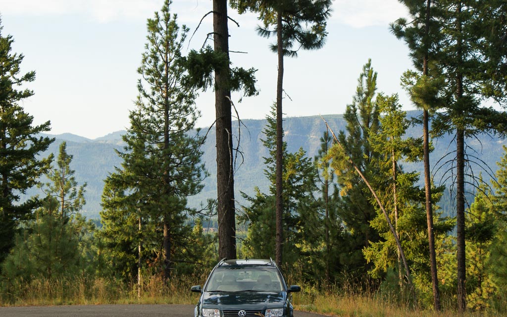
Cle Elum Ridge is high above the city of Cle Elum an hour east of Seattle. This ridge is just north of the I-90 freeway. It is said to have a great eastern exposure for working HF contests and plenty of trees for supporting long wire and dipole antennas.
Does anyone know how to drive up to the north ridge? I tried several forest service roads from Roslyn and Ronald, to no avail. They were all gated or posted "no motor vehicles". I joined the weak signal net from a cul-de-sac in a newer housing development from Hwy 903, but VHF propagation was very poor. Apparently there is no direct signal path to anywhere; my best results to Kirkland were by reflecting off the south ridge. I did, however, contact KC7I in CN84 around Corvallis, OR, about 210 miles SW.
Not far away, on the south side of I-90, are Quartz Moutain and South Cle Elum Ridge, which offers some additional altitude. Better yet is Keechelus Ridge at 6,000'.
CN86-87-96-97, CN97aa00
| Latitude, Longitude |
|---|
| 47.000000, -122.000000 |
I wonder if there are enough roads in this remote area near Mt Rainier to support grid square circling?
One report shows hams camped on Poch Peak south of Carbonado for the June 2004 VHF contest.
Badger Mt, CN97vo90
| Latitude, Longitude |
|---|
| 47.584920, -120.173010 |
Recommended by a ham in Wenatchee. The ski hill top is located at an elevation of 3,500 feet about 700 feet down from the top of Badger Mtn on the east slope, so there's no VHF path to the west with all of Seattle's VHF activity. But it's easy to reach from Wenatchee and has good path to Spokane and Coeur d'Alene.
However, it's not the best location: It has no path to the West because it's at approximately 3,500', which is about 1,000' down from the Badger Mtn summit facing East. (There's no place to set up and operate from the top of Badger.) Also, there's a ridge line from ESE that connects into the mountain on over to the NW. That position does work well into the Spokane area, however. But there's very little VHF activity in the generally eastward direction unless there's rover activity.
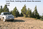
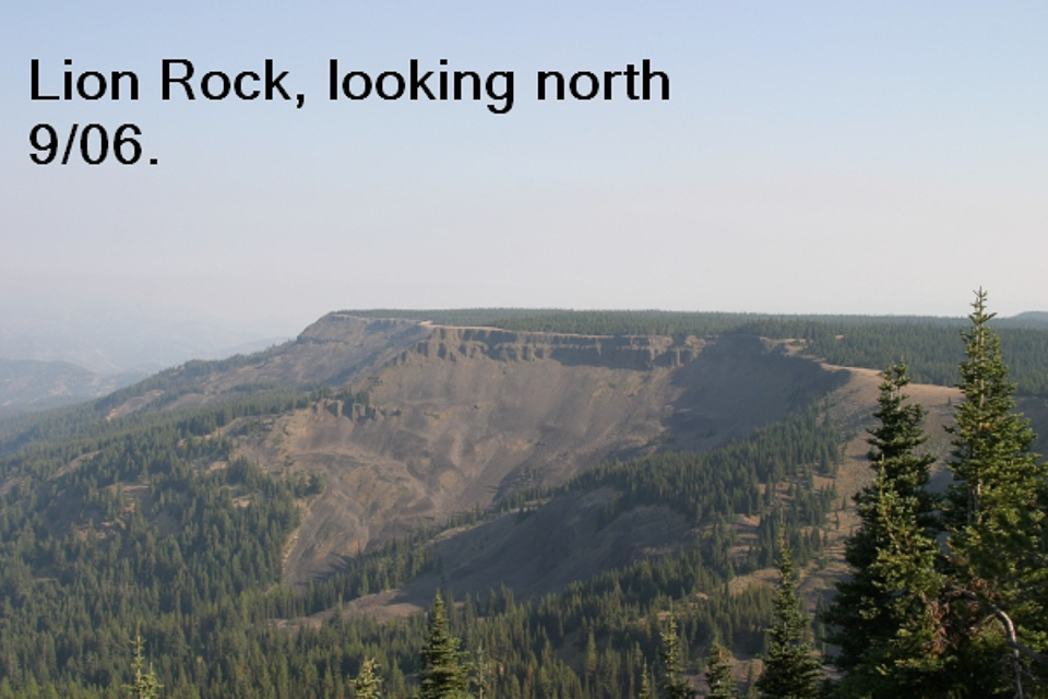
Lion Rock/Table Mtn, CN97rg00
| Latitude, Longitude |
|---|
| 47.250800, -120.577550 |
This is a popular astronomy site, and even has a webpage! There is a paved road up most of the mountain. It is single lane with frequent pull-offs and is frequently navigated by RVs and motor homes. There are three good operating locations in this area.
- Table Mountain: N47.250833 W120.57755, CN97rg, 6200'
To get to this location, drive to the "T" at the top of the road. Go left about 1/4 mile and look for a grove of evergreens to the south. There is a road going to this location and lots of room. This location gives you an excellent exposure to the south and east and an OK exposure to the west. Unfortunately Lion Rock is to the west and blocks the path.

- Lion Rock: N47.25241667 W120.58565, CN97qg, 6300'
To get to Lion Rock, go past the Table Mountain Location and follow the Lion Rock signs. The road has recently been improved, but is still rough with a lot of sharp rocks. The operating location has an excellent exposure in all directions. It is a popular camping site, so you may have company.

- Table Mt. Road: N47.2355667 W120.5659833, CN97rf
Lynn spotted this location during the September VHF contest. It is about two miles south of the "T" on the road up the hill and at 5950' is only about 250' below the Table Mountain location. It has an excellent exposure to the west.
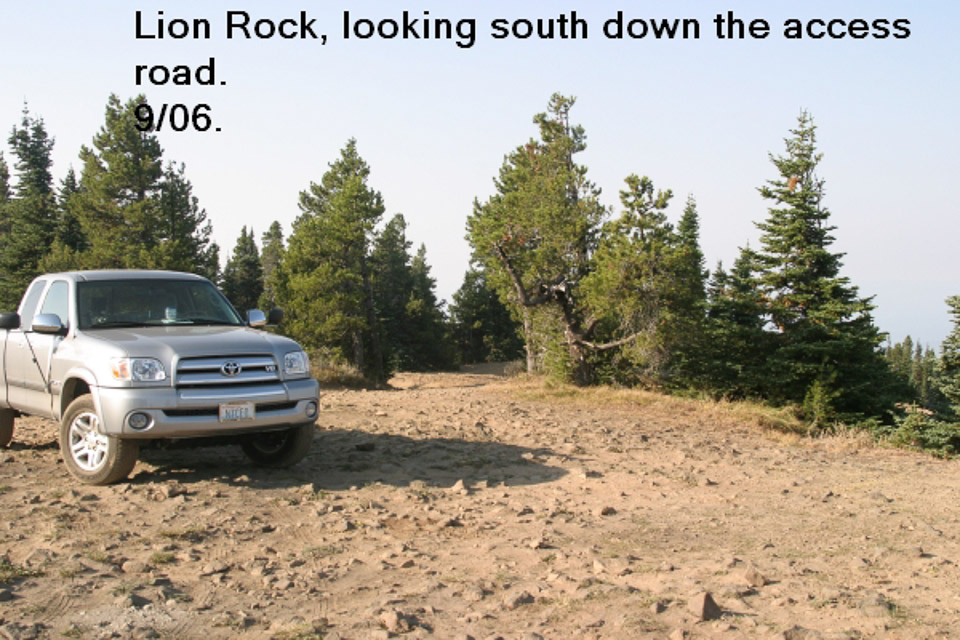
Driving directions: See the list above. The road gets a bit steep in places, but should be no problem.
- Coming down can be another story, especially if you are in a heavy rig.
- The road has a lot of switchbacks, so you have to use your brakes or engine
braking to control your speed.
- Frequent stops are necessary to allow your brakes to cool.
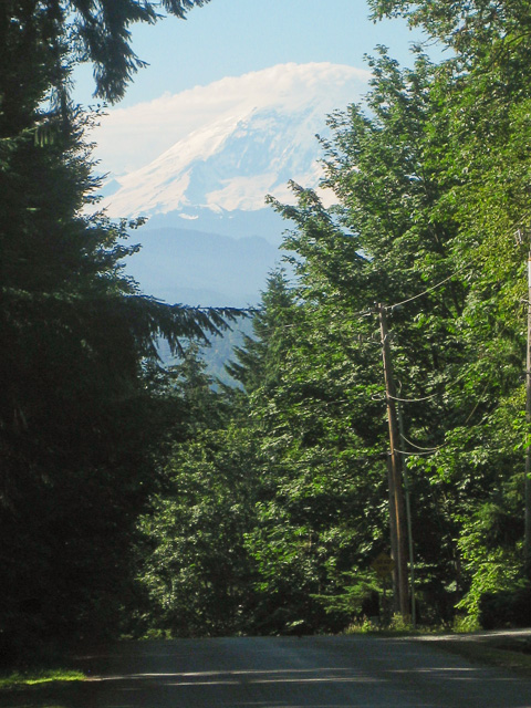
Mirrormont, CN97al01
| Latitude, Longitude |
|---|
| 47.464054, -121.999676 |
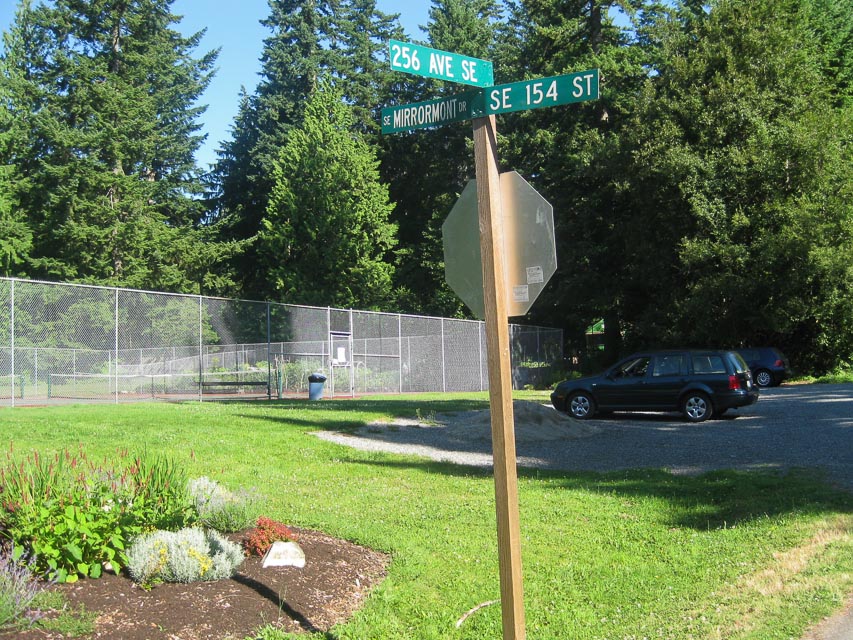
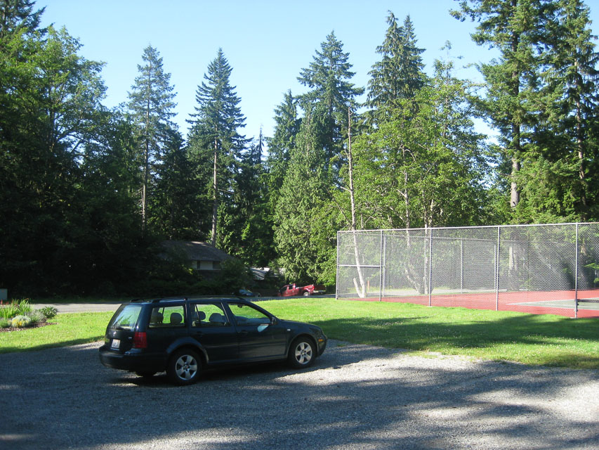
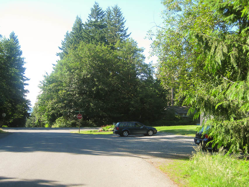
On the south side of Tiger Mt is a nice hill with good exposure. The country club parking area by the tennis courts are the extreme edge of CN97. The grid square CN87-CN97 dividing line runs N-S between the two courts.
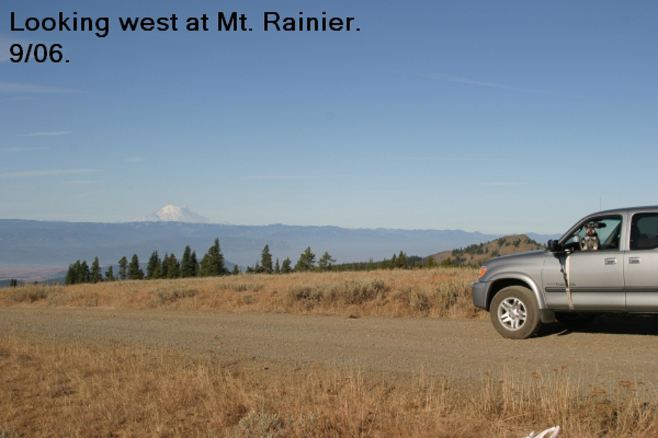
For my first time ever I had solid contact in Portland, Oregon (K7SMA, KC7I). This residential area is loaded with tall trees and a warm southern exposure toward Mt Rainier. I met Kathy a neighbor of my good friend WE7X, and Linda a local pea patch gardener.
Highland Drive, CN97an10
| Latitude, Longitude |
|---|
| 47.545660, -121.989583 |


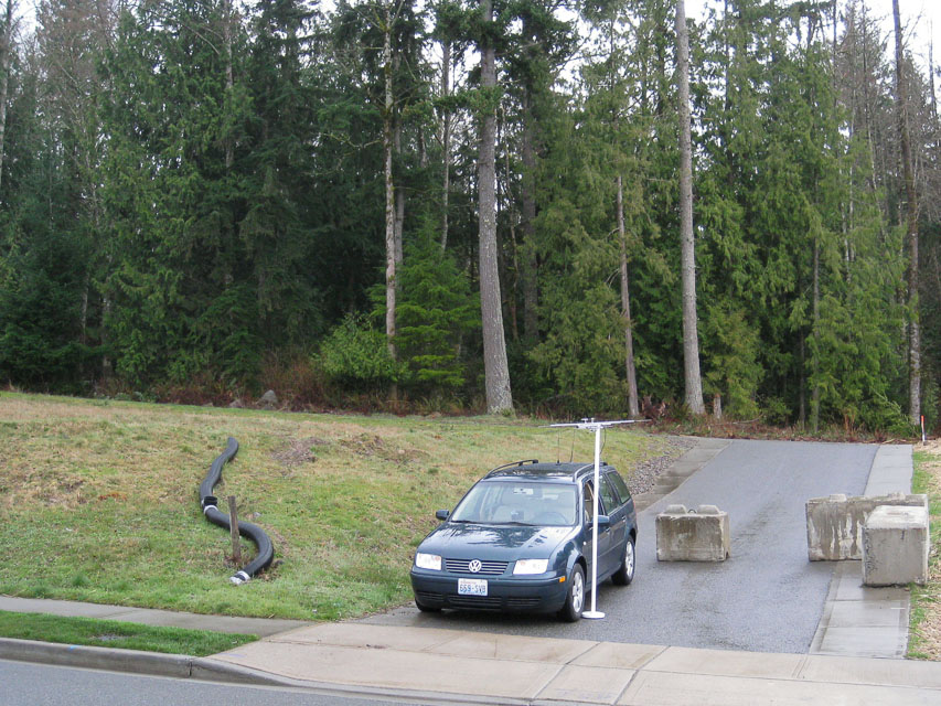
My goal this trip is to get out of CN87. It so happens the border with CN97 is about two miles east. What can we find nearby?
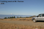
I think I found the highest public roadway on the Sammamish Plateau at 1,022 feet (317m) among the new million-dollar homes above Highland Drive. It has a stunning panorama of Mt Baker to the north and Mt Rainier on the south. At least, it would when it's not raining and dripping everywhere.
I made five contacts including some new hams, all with good reports in the region. I heard some stations in Portland but they were buried in the noise floor and they could not copy me. Net Control said the conditions were quite bad, so I was pleased to hear Portland at all.
The eastward path was dead. Nobody could hear from Spokane at all. But I had some trees and a bit more hill behind me to the east, so I wasn't expecting anything that direction.
More things for my checklist:
- Use the iPhone's Compass app to find magnetic North.
- My lamppost tripod is unreliable on the slightest slope away from horizontal. Worse yet, it's round and rolls easily given the slightest chance.
- Look into building a mast platform that goes under the front wheel.
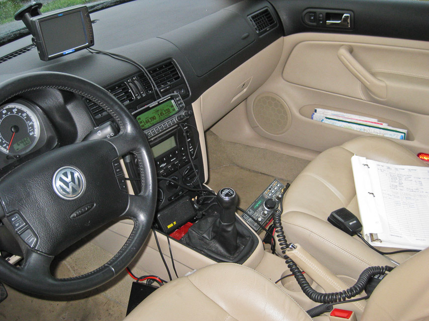
- It's nice to run coax through the door jamb instead of the window. Then I can close the window completely and stay warm and dry. Maybe. A drip loop is required or else the water follows the coax inside.
- There is a PNW VHF S spreadsheet online as a Google doc.
It provides a useful summary of the usual suspects:
http://spreadsheets.google.com/pub?key=0AohgbnNuj9MscDRQdkRhRGNSazFwX0thYnpzV29lRkE&gid=0 - I met G4AMD/7 on the air and we had a great chat about VHF propagation. There are a lot of interesting things that can happen to VHF / UHF signals, and there is a lot of fun stuff to learn.
Mission Peak, CN97sg69
| Latitude, Longitude |
|---|
| 47.287648, -120.445594 |
You can drive almost to the summit of Mission Peak. Surely there is some spot along the ridge near the top that has good propagation east and west.
| < Previous | Page 15 of 24 | Next > |
©1998-2024 Barry Hansen