Rover Location Database
United States Rover Locations
- USA
- USA List
- BO Alaska
- BP Alaska
- CM California
- CN Pacific NW
- CO Canada
- DL Mexico
- DM Southwest
- DN Rockies
- DO Canada
- EL Texas Florida
- EM South
- EN Central
- EO Canada
- FM East Coast
- FN Northeast
- FO Canada
- Select Grid
- Data Check
- Add a Place
Grid Field EM
30 locations - EM06-07-16-17 - Tech College - Florida State Trail Trailhead Hwy 20 - Bald Knob - Two Churches - Boat Ramp - Church Parking Lot - Snellville Mtn - Dowdell Knob - Social Circle Park - Georgia Horse Park - Crisp County Baseball - I-75 Dirt Lot - Christmas Tree Rd - Old Gate Rd - Cherry Point Boat Landing - Glennville Rec - Brantley Parks/Rec - US-25 Spur Old Parking Lot - Toxaway Mountain - Russ Point - Cheaha Mountain - Mount Oglethorpe - Buck Bald - Woody Gap - Griswoldville Industrial Blvd - Joe W0FY - Pine Mtn - Morris Gap - Koomer Ridge
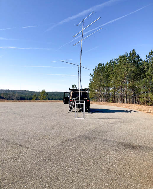
Potential VHF rover sites in grid EM.
EM dimensions are 1655.8 by 1623.5 miles.
EM06-07-16-17, EM06xx58
| Latitude, Longitude |
|---|
| 36.995155, -98.038120 |
If a rover is interested, the grid corner for EM06 07 16 17 is easy to circle. KB0HH used to have a large contest station in EM06 but that is no more and has been disassembled.
Tech College, EM80fb18
| Latitude, Longitude |
|---|
| 30.078327, -83.568380 |
The Big Bend Technical College offers a convenient large parking lot with easy access from the S Byron Butler Pkwy.
Driving directions:
From US 19/98 turn west onto Industrial Drive and look for
parking lots on your left.
Restrictions: Be aware of school schedule to predict times of heavy parking lot usage. I was here in the evening and nobody bothered me.
Florida State Trail Trailhead Hwy 20, EM70ek62
| Latitude, Longitude |
|---|
| 30.428205, -85.609640 |
This is a parking lot for the Florida State Trail.
Driving directions: It is best to put the coordinates in your GPS. Look for a very small triangular sign that is very easy to miss. I arrived here after dark and drove right by it.
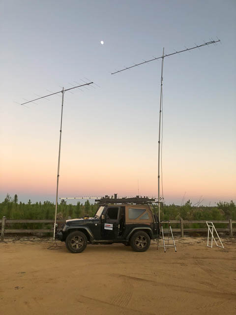
Bald Knob, EM62vm68
| Latitude, Longitude |
|---|
| 32.534176, -86.193730 |
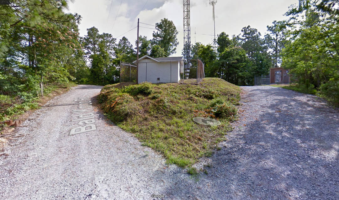
Bald Knob is part of an ancient meteor impact crater. I thought this was appropriate since I would be doing meteor scatter. There are a few radio towers up there.
Driving directions:
Wetumpka is NW of Montgomery on US 231.
- Turn onto Knight St from US 231
- In 0.1 mi turn left onto Hillside Drive
- In 0.1 mi turn left onto Enslen Road
- In 290 feet turn left onto Bald Knob Road
Two Churches, EM61xv90
| Latitude, Longitude |
|---|
| 31.878061, -86.003040 |
This spot is a dead end road just off US 231. It runs between two churches and dead ends just before 231.
Driving directions: About 5 miles north of Troy.
From US 231 turn east onto Orion Rd
At next turn right onto the dead end road
Boat Ramp, EM60vk20
| Latitude, Longitude |
|---|
| 30.419179, -86.228090 |
This boat ramp on "N County Hwy 393" is a small unimproved boat ramp on the south shore of Chochtawhatchee Bay. I set up in a small sandy area just to the west of the road. The sand is loose and might not be appropriate for passenger cars.
Driving directions: 3198 N County Hwy 393, Santa Rosa Beach, FL 32459
Church Parking Lot, EM51lw12
| Latitude, Longitude |
|---|
| 31.926379, -89.074790 |
This location is in a small Methodist Church parking lot.
Driving directions:
1718-1720 Co Rd 31, Heidelberg, MS 39439
Exit I-59 at exit 113.
Head northwest on MS-528 W/Pine Ave for 4.3 miles.
Turn right onto Co Rd 31.
In 0.2 miles the church is on the left.
Snellville Mtn, EM73xu65
| Latitude, Longitude |
|---|
| 33.856858, -84.027006 |
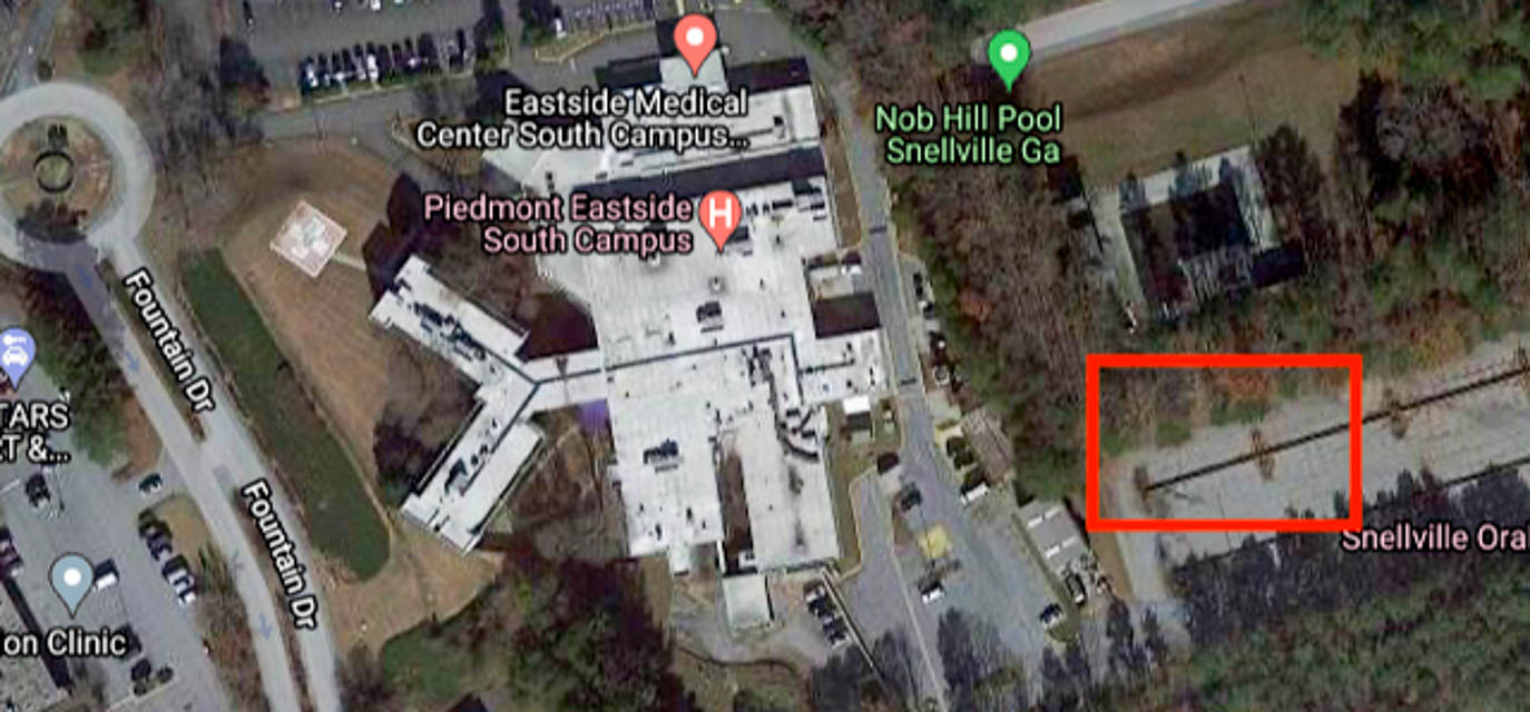
"Snellville Mountain" is an unused parking lot behind Eastside Medical Center. It is on Snellville Mountain although not right at the highest point.
It's about 200 ft about average terrain. It offers good results in most directions. Jeff WB8LYJ uses this location for VHF contests, including September 2020. There is a little noise in a few directions but nothing too bad.
Driving directions: The location is off of US-78 just west of the junction with GA-124. Take Fountain Dr north. Turn into the hospital and drive by the Emergency Room entrance and up the hill. At the end bear right into the abandoned parking lot.
Restrictions: None. I have been here at all hours and nobody has bothered me.
Dowdell Knob, EM72pu01
| Latitude, Longitude |
|---|
| 32.840829, -84.745458 |
Dowdell Knob is part of FD Rosevelt State Park. This was FDR's favorite picnic spot. It has great open views to the south.
This location works well. It has radio line-of-sight from 25 to 35 miles in most directions and more in a few others.
There are, however, a few issues with the location. The parking can be crowded. It is a popular spot. The parking has overhead tree limbs which can limit antenna height. The location has published limited hours starting at 8:00, but the rangers are never on time opening the gate. Jeff WB8LYJ was here in summer of 2020.
Driving directions:
From Warm Springs take Alt US-27 Alt southbound.
Turn right onto GA-190 W and go 1.6 miles.
Look for the red "state park" sign on the left. It's not large so don't miss it.
Follow the road 1.3 miles.
At the end, bear right and park in one of the small 3 or 4 car parking areas.
The main parking is open but 100' lower. All roads are paved.
Restrictions: Restricted hours. Parking fee.
Social Circle Park, EM83dp37
| Latitude, Longitude |
|---|
| 33.656378, -83.719868 |
This location is a small park in downtown Social Circle next to the Post Office. There has never been anyone there when Jeff WB8LYJ has visited.
Social Circle is on the top of hill. The location works fairly well on the air. Jeff WB8LYJ uses the location in the VHF contests and was there in January 2021.
Driving directions:
Take I-20 at get off on Exit 98.
Take GA-11 north 2.5 miles.
Turn left on S. Cherokee Rd.
Go 1.2 miles into downtown Social Circle.
Turn left on W. Hightower Trail.
Go 400' and turn left into the park.
Restrictions: Probably limited to daylight hours, like most city parks.
Georgia Horse Park, EM83aq70
| Latitude, Longitude |
|---|
| 33.669629, -83.933699 |
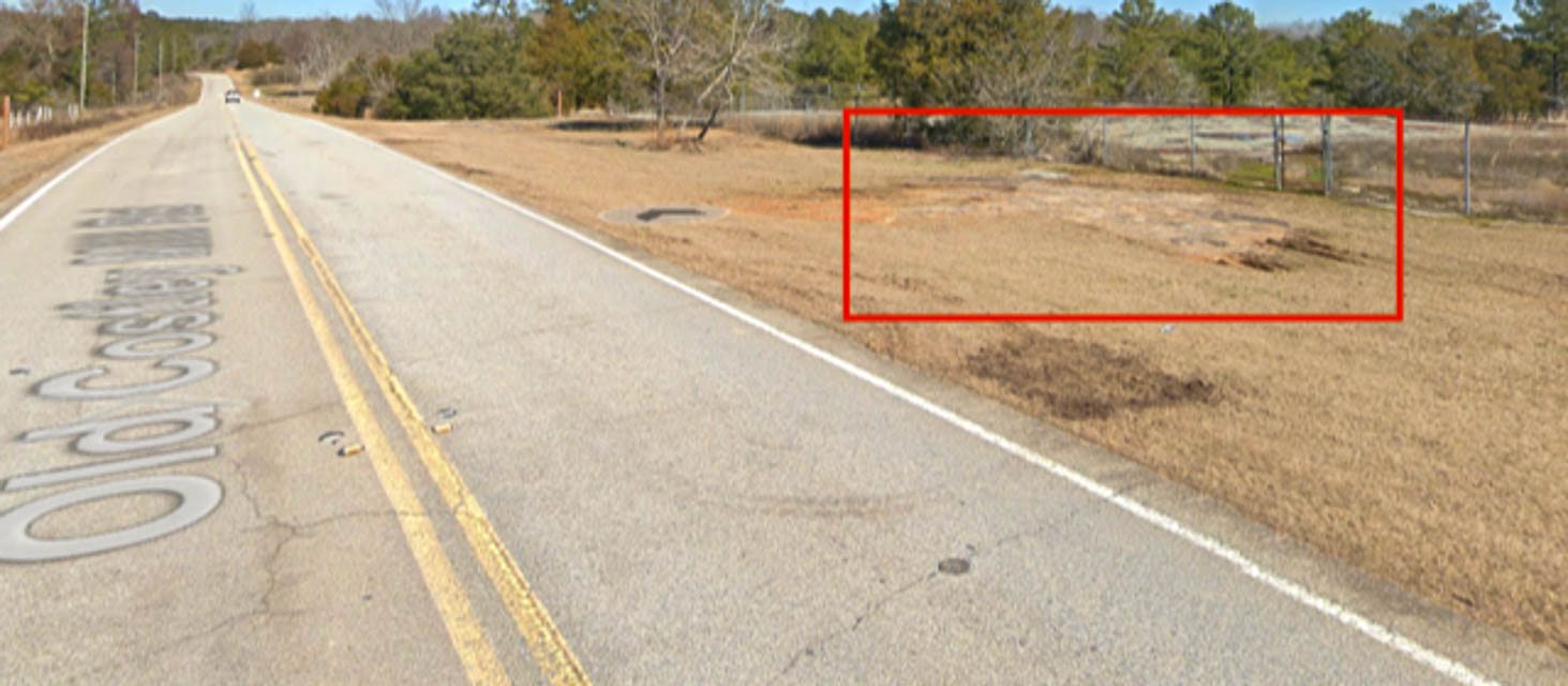
Georgia International Horse Park is the EM83 location used by Jeff WB8LYJ for some contests and casual operating. It's up on top of a small hill.
The only issue here is some noise from south from a small solar farm. The noise hasn't been an issue in other directions. I come here because it is close to home and just across the line into EM83 from my home grid EM73.
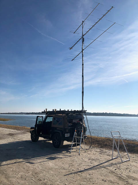
Shown above is the street view of this International Horse Park location. The funny thing is those are probably my tire tracks. I always stop on top of that rock. If you straddle it just right you don’t have to level the vehicle.
Driving directions:
Drive on I-20 and take Exit 82 onto GA-138.
Go north on GA-138 3.6 miles.
Turn right on Centennial Olympic Parkway.
Drive 2.3 miles and turn left on Old Costley Mill Rd.
In about 0.2 mile there will be a grassy area along the
right side of the road with a few rock outcroppings.
Pull in there and set up.
Crisp County Baseball, EM81cx83
| Latitude, Longitude |
|---|
| 31.971183, -83.761275 |
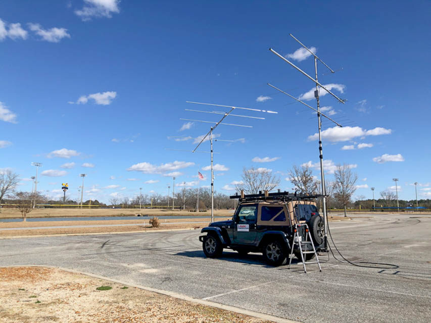
Crisp County Youth Ball Complex is a sprawling baseball complex. There are lots of different parking lots to choose from.
Jeff WB8LYJ has used this location in the ARRL VHF and CQ WWW VHF contests. It offers wide open spaces and easy access to I-75. He was last here January 2021.
Driving directions:
Take I-75 to exit 102, Cordele.
Go west a short distance and look for the "Crisp County Youth Ball Complex" sign on the left.
Restrictions:
I haven't seen any signs that restrict access hours.
I've always visited during daylight or a little bit after sunset, YMMV.
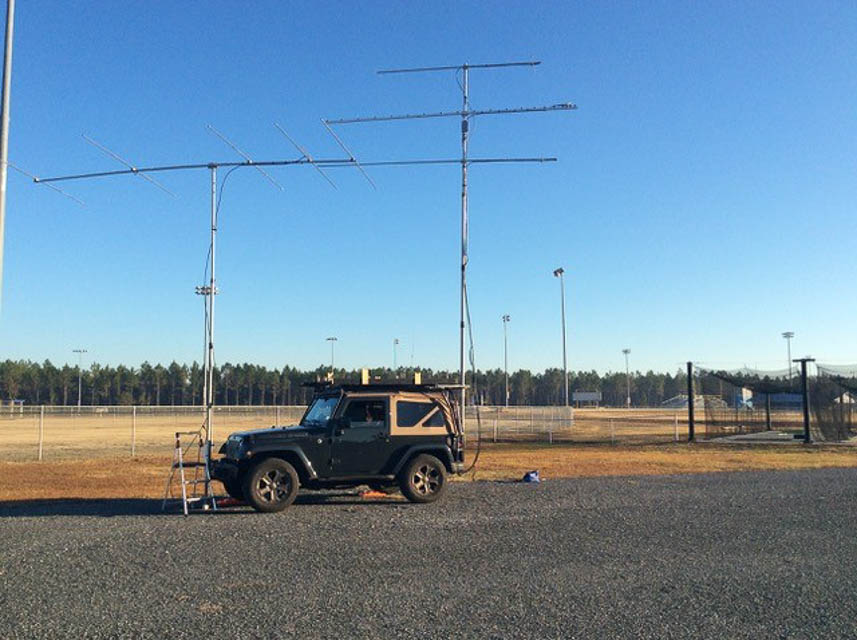
I-75 Dirt Lot, EM80hx37
| Latitude, Longitude |
|---|
| 30.990650, -83.386026 |
"Dirt Lot by I-75" is a dirt lot very near I-75 exit 29, Hahira GA. It looks like it was previously used during road construction.
Jeff WB8LYJ uses this location in both the ARRL VHF Contests and CQ WWW VHF contests. It offers quick on and off of I-75. He was last here in January 2021.
Driving directions:
Take I-75 to Exit 29.
Head east and take the first right onto Union Rd.
Take the next right onto a short paved road that leads to the lot.
Christmas Tree Rd, EM94xe59
| Latitude, Longitude |
|---|
| 34.207539, -80.037502 |
Christmas Tree Road is a dead-end road near I-20. Depending on the mapping site this road is either called Christmas Tree or Buck Reynolds. It is on the south side of I-20 just across the grid line with FM04.
Jeff WB8LYJ was here in August of 2021 running meteor scatter and tropo. It worked well. It is fairly quick to get on and off of I-20.
Driving directions:
From I-20 take exit 131.
Drive south on 403 and take the next right onto Oates Hwy.
Take the next right onto Christmas Tree / Buck Reynolds.
If you cross I-20 you missed it.
Old Gate Rd, EM93hv96
| Latitude, Longitude |
|---|
| 33.903119, -81.339161 |
Old Gate Rd is a dirt frontage road that ends near I-20. It is about 40' above the I-20 freeway.
Jeff WB8LYJ visited to operate meteor scatter and tropo in August 2021, and both modes worked well from here. The only problem here is the occasional ignition noise from I-20 traffic.
Driving directions:
Exit 1-20 at exit 44, County Rd 34 Pond Branch Rd.
Go east on 34 4.3 miles to Calks Ferry Rd.
Turn left on Calks Ferry.
Go 2.9 miles and turn left on Old Gate.
Continue to the end.
The road is a bit rough near the end but should be ok in a passenger car.
Cherry Point Boat Landing, EM92vo83
| Latitude, Longitude |
|---|
| 32.597877, -80.182532 |
Cherry Point Boat Landing is a boat launch on Wadmalaw Island south of Charleston.
Jeff WB8LYJ was here for meteor scatter and tropo in August 2021; it worked well.
Driving directions:
Boat Landing Alley, Wadmalaw Island, SC 29487
From Charleston, take SC-700 almost to Rockville.
Turn left on Cherry Point Rd.
Follow signs to the boat landing.
Glennville Rec, EM91aw57
| Latitude, Longitude |
|---|
| 31.948484, -81.956370 |
Glennville Recreation is a large recreation complex with baseball diamonds, a lake, and a walking trail. There is plenty of room to set up. It's in the upper NW corner of EM91.
On the air: Jeff WB8LYJ was here in January of 2021 doing meteor scatter and tropo during the Quadrantids meteor shower. It worked pretty well. West and NW paths are pretty clear over the lake and baseball diamonds. He chose this location for ease of access from home.
Driving directions: 320 Veterans Dr, Glennville, GA 30427
Restrictions: Daylight only.
Brantley Parks/Rec, EM91ae79
| Latitude, Longitude |
|---|
| 31.205883, -81.935863 |
Brantley Parks and Recreation is a large recreation complex with multiple baseball diamonds and soccer fields.
Jeff WB8LYJ was here doing meteor scatter and some tropo in December 2020. It's a nice clear area with very few trees. It worked good enough.
Driving directions:
Brantley County Recreation Department, 3540 Baker Creek Rd, Nahunta, GA 31553
From I-95 take US-82 west 24 miles.
Restrictions: Daylight only.
US-25 Spur Old Parking Lot, EM90dw68
| Latitude, Longitude |
|---|
| 30.952958, -81.699643 |
This is the site of some sort of old business, maybe a gas station or produce stand. The lot is a mix of dirt and pavement. I needed a spot along the north edge of EM90 with quick access to I-95 and this did the trick.
On the air: Jeff WB8LYJ was here running meteor scatter and some tropo in December 2020. This was the start of his trip up the coast. It worked well enough.
Driving directions:
From I-95 take exit 14 to GA-25 Spur S/10th St/Satilla Bluff Rd west toward Woodbine.
The location is 1.2 miles on your right.
Restrictions: None
Toxaway Mountain, EM85md21
| Latitude, Longitude |
|---|
| 35.131954, -82.982987 |
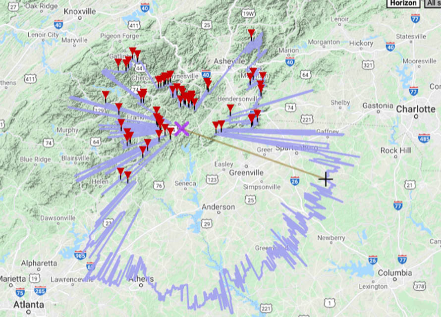
Toxaway mountain is a drive-up summit in southern North Carolina, in the Pisgah National Forest somewhat SW of Asheville.
The road up is paved except a short section near the top. It is all residential, narrow, and very twisty and it takes awhile to get there from the main highway. Once at the tower you can pull off into the grass and set up.
On the air: Best directions are SE through E with radio line-of-sight distances of 80 to 90 miles. West is probably the worst direction.
Jeff WB8LYJ was there in August of 2020 for the 222 and Up contest. It seemed that conditions may not have been that great. The weather was bad with rain and fog at the summit. Despite this I made 222 contacts into the Florida panhandle.
There are a bunch of towers here but I didn't experience any interference that I noticed. Since I was only on 222 and 432 there might be some issues with 6m or 2m.
Driving directions:
From US-64 turn north on Tower Rd.
Follow Tower Rd 3.1 miles to the end.
Russ Point, EM92si32
| Latitude, Longitude |
|---|
| 32.345805, -80.469217 |
Russ Point Boar Landing Hunting Island State Park is a small boat ramp at the south end of Hunting Island SP.
Jeff WB8LYJ operated meteor scatter and tropo from here in Dec 2020. To the west is over water.
Driving directions:
From Beufort, head east on US-21 Sea Island Pkwy through Hunting Island SP.
Before crossing the bridge to Fripp Island, take a right at the "Welcome to Fripp Island" sign.
Cheaha Mountain, EM73cl26
| Latitude, Longitude |
|---|
| 33.485257, -85.808430 |
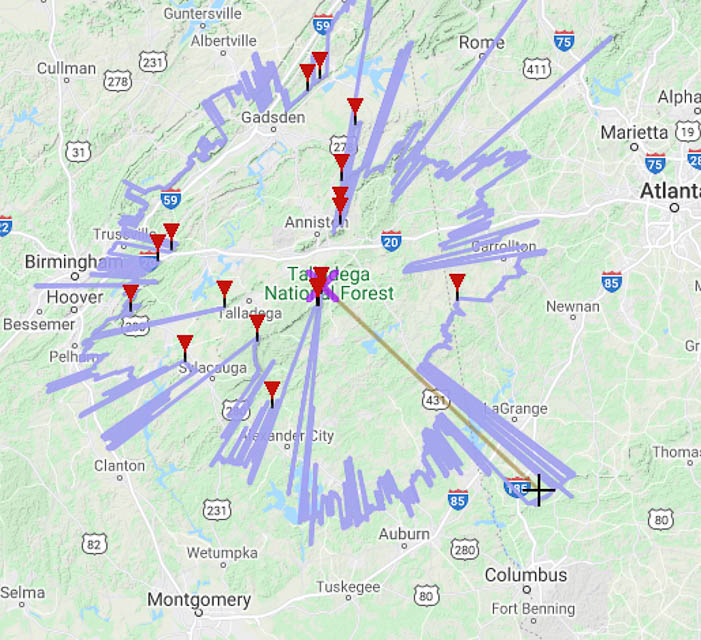
Cheaha mountain is the highest point in Alabama and the peak is in Cheaha State park. Camping, a Lodge, Cabins, a park store, and a restaurant are there.
Driving directions: From I-20 exit at US-431 and go south to AL-281.
Restrictions: Park access fee is required. I think you can get into the park any time if you already have the pass. The pass can be purchased at the park store. The store is only open during the day.
Mount Oglethorpe, EM74ul06
| Latitude, Longitude |
|---|
| 34.485990, -84.331317 |
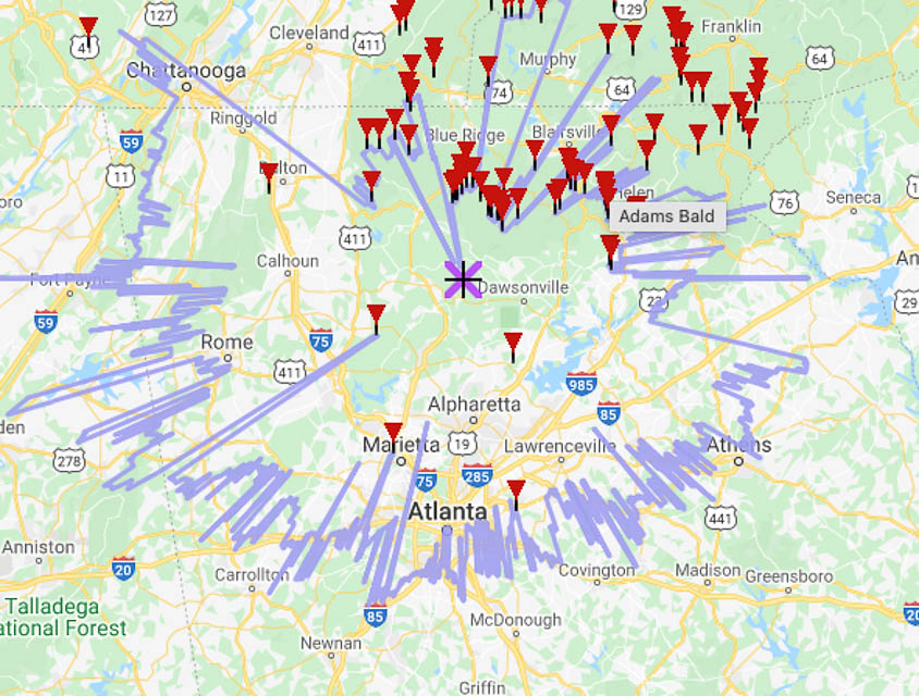
Eagles Rest Park on top of Mount Oglethorpe sits out in front of a lot of the north Georgia mountains. It isn't the highest around but it works ok and you can drive to the summit.
Driving directions:
From Jasper take Burnt Mountain Rd to GA-136.
Turn right on GA-136 to Monument Rd.
Turn right onto Monument Rd. Continue to the end.
Restrictions: Daylight hours only.
Buck Bald, EM75ue18
| Latitude, Longitude |
|---|
| 35.203422, -84.323674 |
Buck Bald Mtn Scenic Area is a drive-up summit in eastern Tennessee, in the Great Smoky Mountains National Park.
It doesn't look super when looking at in HeyWhatsThat. It worked surprisingly well though. Best direction is NNW to N. Radio line of sight in those directions is 55 to 90 miles.
Jeff WB8LYJ was here for the 2020 222-and-up contest. He made 222 FT8 contacts into northern IL and TX, and contacts using 432 contacts into IL, MO, AR.
Driving directions:
From Telleco Plains, go south on TN-68 and take Buck Bald Rd (Old State Hwy 68).
The road is rough with large rocks and some ruts. Accessible by car with some caution.
I drove up at 3am and I think I hit every rock and rut in that road.
Coming down in daylight it was much easier to miss all the hazards.
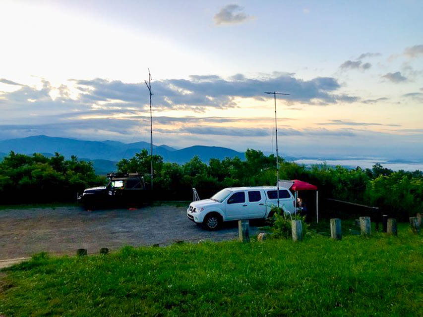
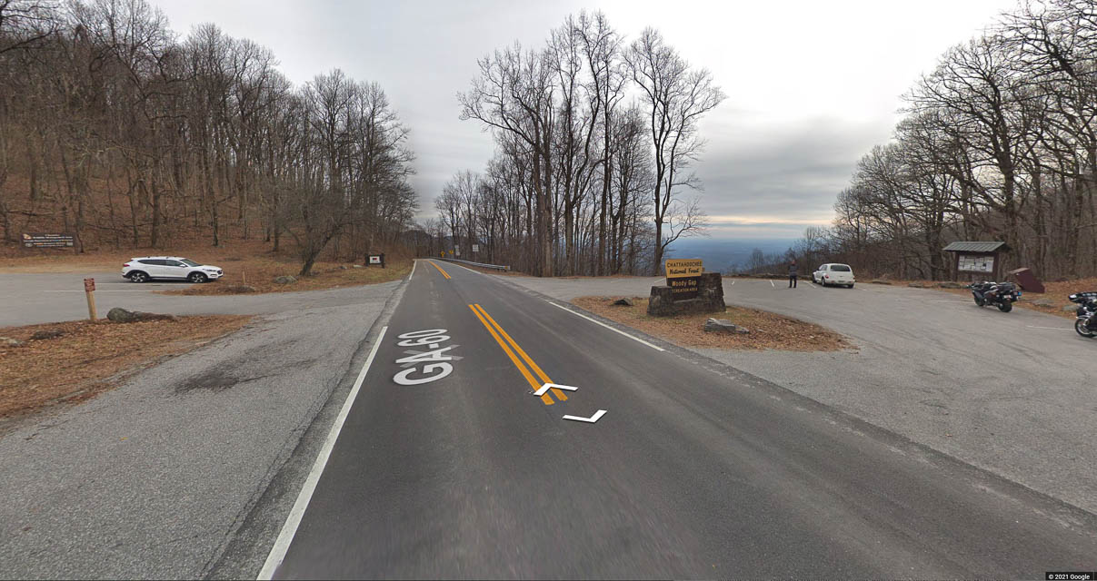
Woody Gap, EM74xq92
| Latitude, Longitude |
|---|
| 34.677472, -84.000042 |
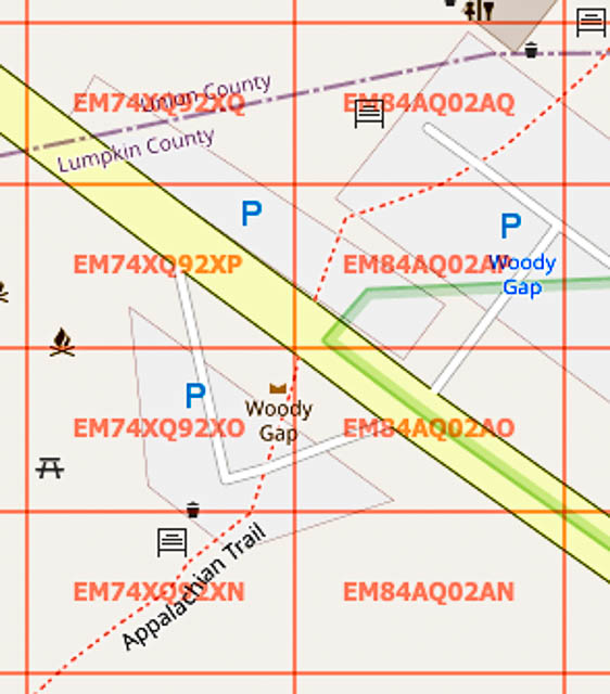
Woody Gap offers the EM74-EM84 grid line, and nifty access to the Appalachian Trail for hikers and picnics. There are two parking lots; the south side of the road has the best view.
The eastern two parking places are in EM84aq and the rest to the west are in EM74xq. The north parking lot is all in EM84. You could probably get on the grid like to activate both grids. This wouldn't be useful for contests though since they require you to move the station 100m. There isn't that much space to do that.
Since Woody Gap sits between two mountains, the field of view is only open to the south. There, the radio horizon stretches out 50 to 70 miles. Radio is excellent in that direction.
Driving directions:
From Dahlonega, take US-19 north 8.4 miles to where GA-60 splits.
At traffic circle, take 2nd exit onto GA-60.
Follow GA-60 for 5.4 miles to Woody Gap. Watch for the Woody Gap sign.
Restrictions: There is a vault toilet. No water. More info at Woody Gap Trailhead.
Griswoldville Industrial Blvd, EM82fu97
| Latitude, Longitude |
|---|
| 32.865803, -83.508165 |
A cul-de-sac at the end of an industrial street. There is only one industry on the road about 0.6 miles away.
This is a standard spot for me; I go there often. I've used it in the VHF contests and to do grid activations on 6m, 2m, 1.25m, and 70cm.
This spot sits at the end of a ridge. The terrain drops off everywhere except south. There is a clear view west and south west. There are trees in the other directions but elevation drops off quickly. The south end of the street is about 20' higher so that's probably the worst direction.
Driving directions: East of Macon on GA 57
Restrictions:
I have been here all hours of the day and night and never seen anyone.
Joe W0FY, EM48rp78
| Latitude, Longitude |
|---|
| 38.660553, -90.524152 |
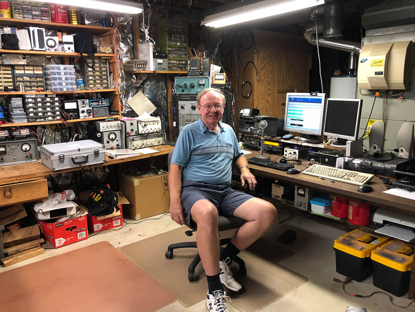
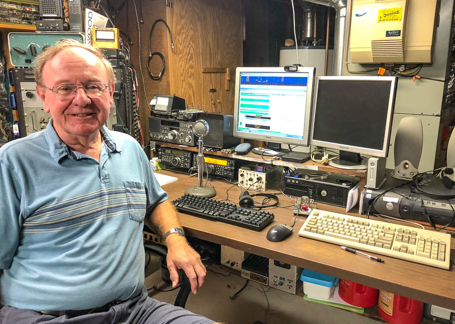
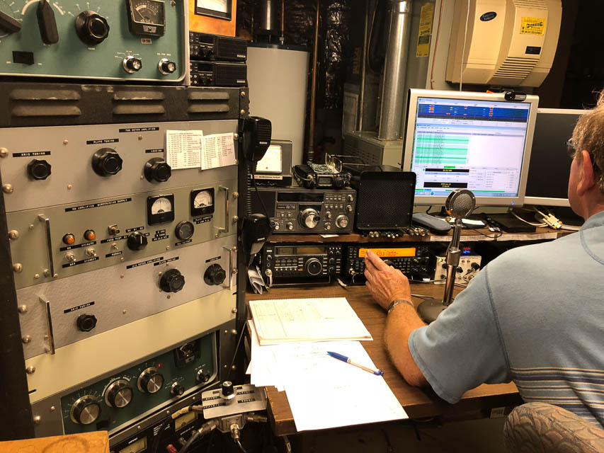
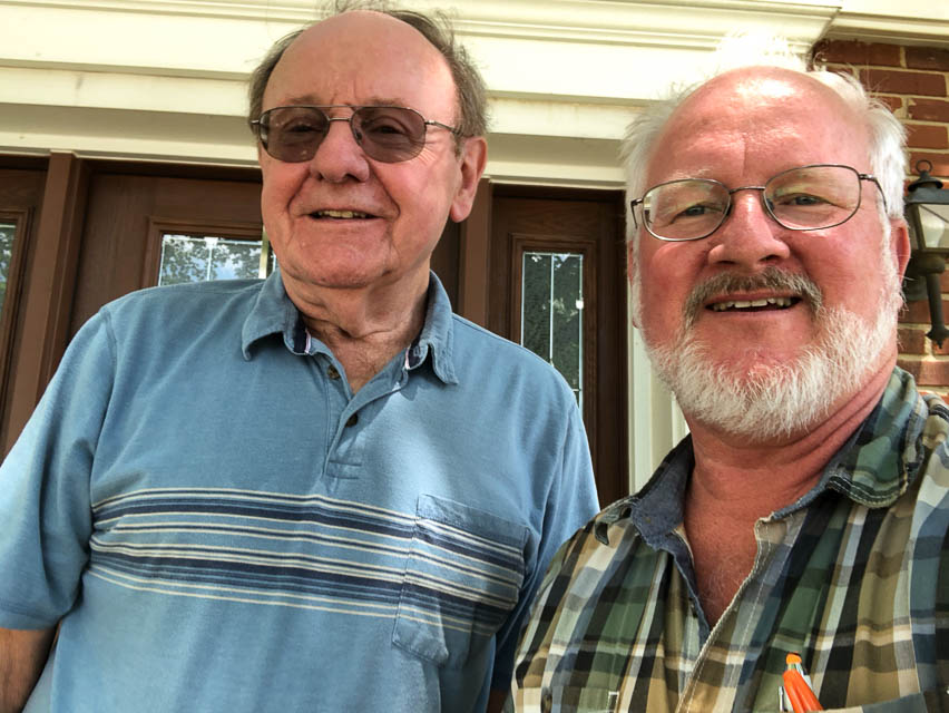
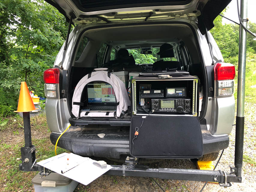
I worked Joe Fleagle W9FY a week earlier from Gold Mtn Lookout in DN08. This was his second-to-last grid needed toward the FFMA award. So, as long as I was driving by anyway, I simply had to stop in and have lunch together. Here is his modest basement station. It's very well organized and well equipped with quality gear, tools and an excellent operator.
Pine Mtn, EM87ob39
| Latitude, Longitude |
|---|
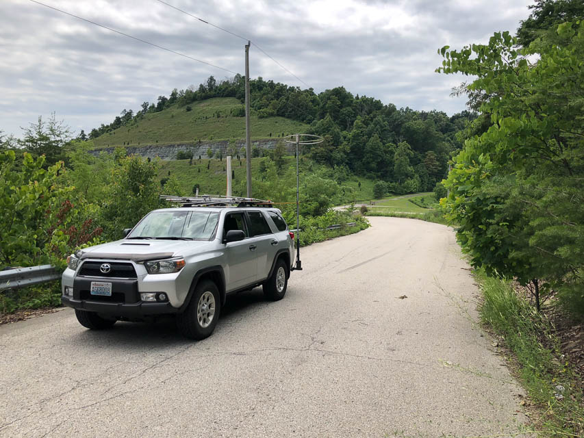
| 37.080290, -82.803520 |


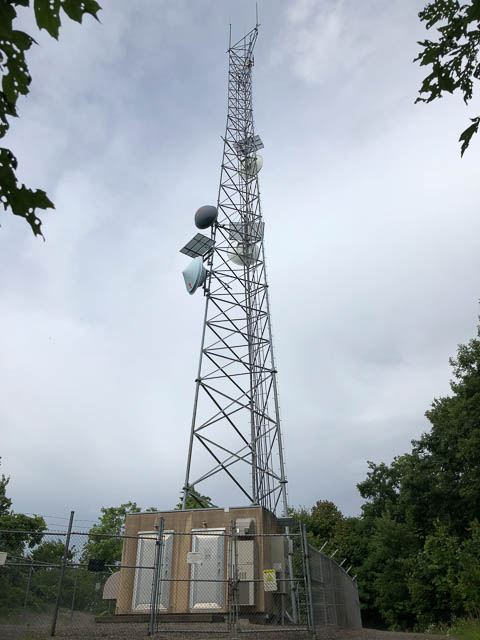
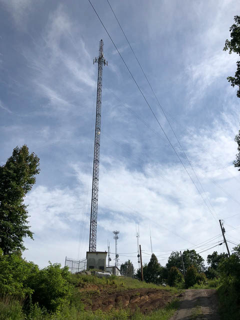

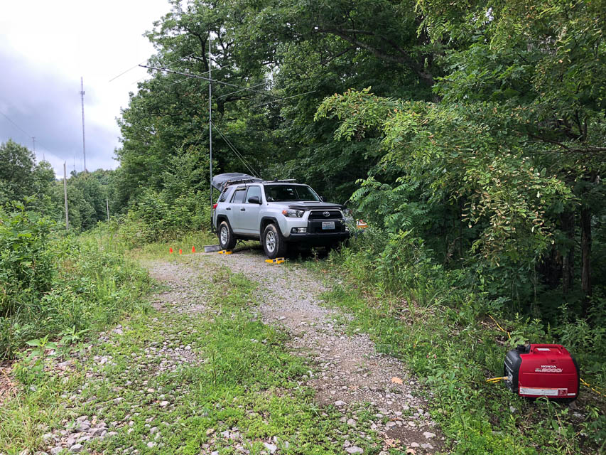
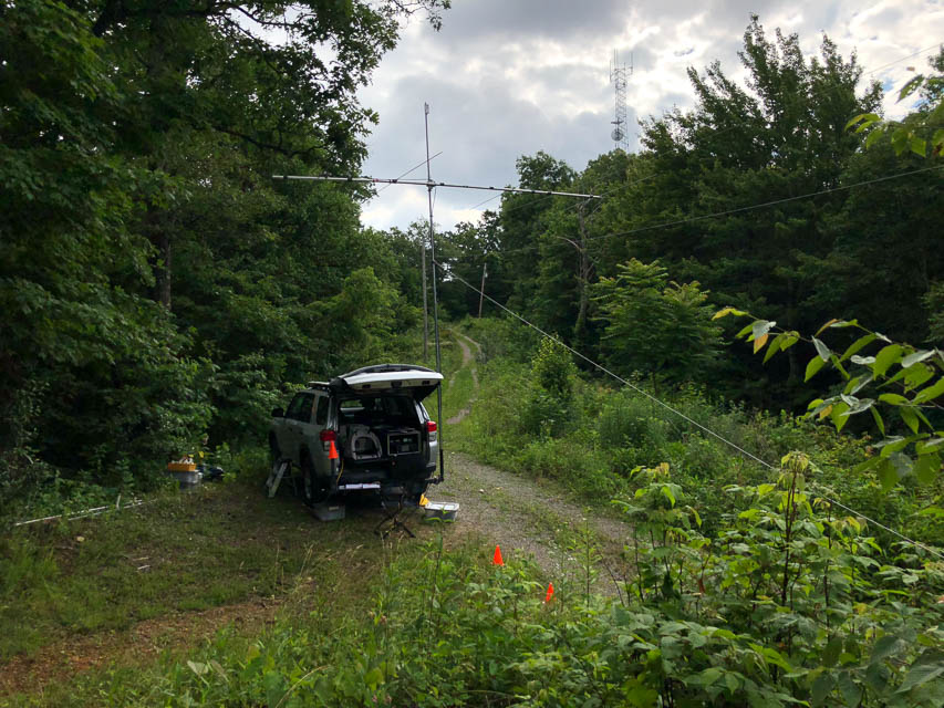
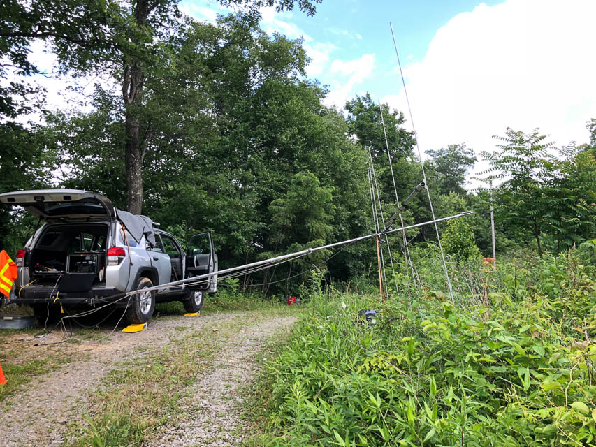
Pine Mtn is a long knife-edge ridge with radio towers at either end. Great operating positions can be found halfway between the towers, with open horizon through the trees in almost all directions. This worked great for me on meteor scatter and a long 6m opening in the 2018 June VHF Contest. I even worked Germany from here.
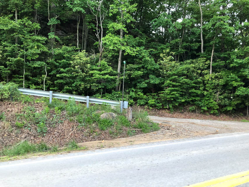
Morris Gap, EM87bv58
| Latitude, Longitude |
|---|
| 37.908910, -83.869670 |

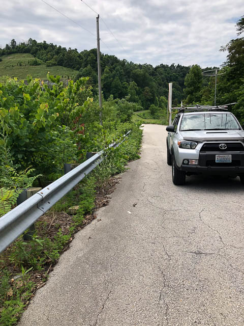
Don't go. This highway over the mountains is gated off. I was searching for an operating spot in EM87 and this was the easiest to try as I entered the grid square, but you can't get very near to the top.
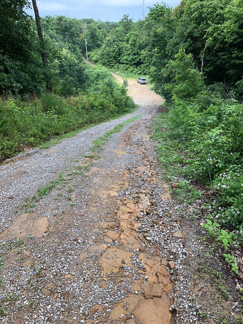
Koomer Ridge, EM87es38
| Latitude, Longitude |
|---|
| 37.784458, -83.636230 |
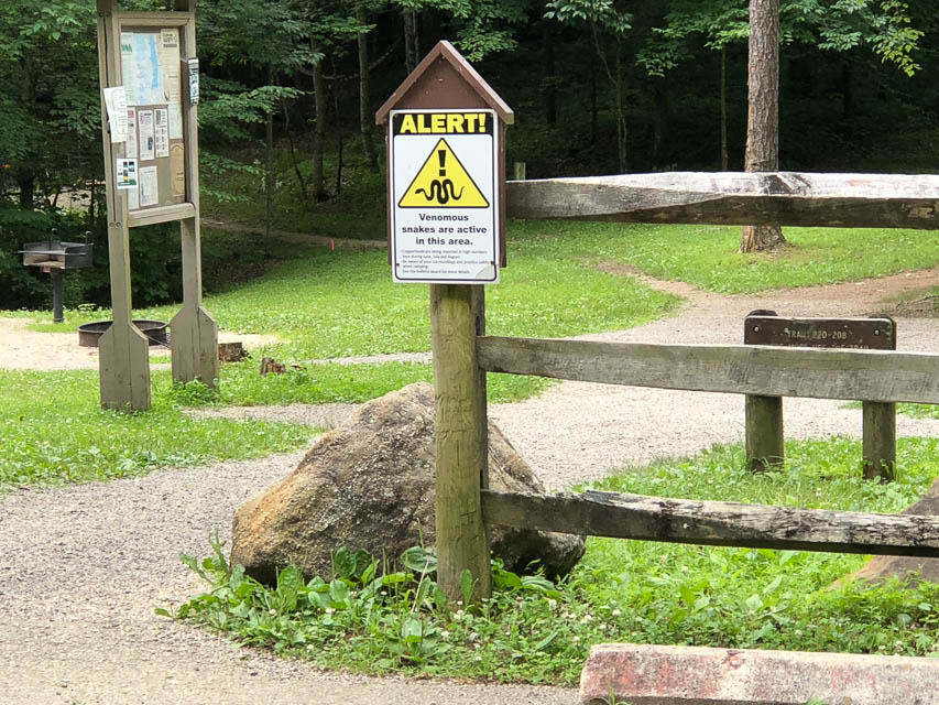
Koomer Ridge is favored with a campground and hiking trails in the Red River Gorge Geological Area of Kentucky. This is heavily forested and, when I visited in mid-June, very thickly populated with biting flies. A sign warns of venomous snakes. I moved along without getting out of my car.
| < Previous | Page 13 of 21 | Next > |
©1998-2024 Barry Hansen